Drivers using the A38 in Sutton Coldfield have been warned after a section of the road was flagged as 'unhealthy' on a new app that rivals Google Maps. The app, called Stan The App, uses artificial intelligence to analyse road surfaces and generate health scores.
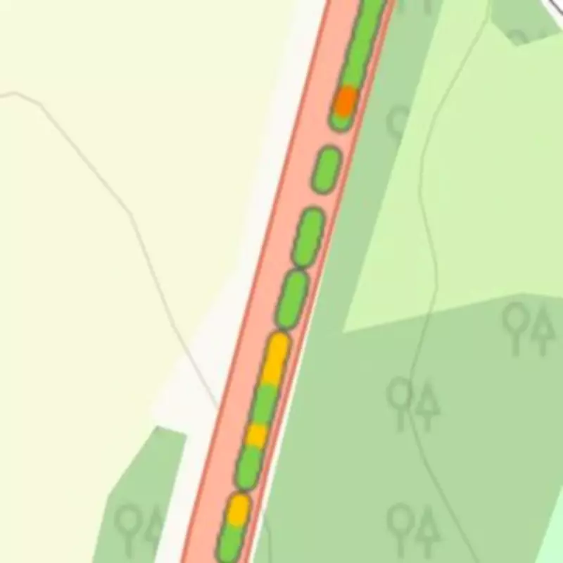
Yellow and orange scores on A38
The A-road, known as the Sutton Coldfield Bypass, is a major route connecting Minworth to the M6 Toll. According to the app, parts of the road between Minworth Island and the M6 Toll junction have received yellow and orange scores, indicating a less-than-ideal condition. While most of the A38 shows green scores—the highest possible—an area near Wishaw Golf Club and Bulls Lane is shaded in yellow and orange.
How the app works
Stan The App allows drivers to record the road ahead using their phone camera. The footage is uploaded and processed by AI technology, which detects defects such as potholes, cracks, and standing water. The app then generates a health score for small sections of road, displayed as colour-coded circles on a bird's-eye map. There are five possible scores: dark red, red, orange, yellow, and green.

Although the app does not specify why particular scores are given, any non-green score indicates that a defect has been detected. A spokesperson for the app explained: 'Stan the App utilises cutting-edge computer vision technology to identify road defects, such as potholes with remarkable accuracy. Your contributions, along with those of other users, help to build a comprehensive database of road defects, enabling the prioritisation of repairs effectively.'
Previous tests
BirminghamLive previously tested the app in May 2024, driving on both urban and rural roads. The app recorded green health scores for roads in north Wolverhampton, but smaller county roads near the Staffordshire border showed more defects.
The A38 warnings come as a reminder for drivers to stay alert and report road issues through such platforms, which can help local authorities prioritise maintenance.