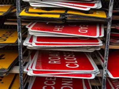
Drivers across England are facing a worsening battle with potholes, with the recent icy weather set to exacerbate the problem. A new government tool now publicly rates how every local authority is performing on the state of its roads.
New Map Exposes Best and Worst Roads
The Department for Transport has launched a colour-coded mapping system that gives each council area a red, amber, or green rating based on road conditions. Areas marked red have the worst roads, while green indicates the best. The tool is designed to increase transparency and hold local highways authorities accountable for maintenance.
Transport Secretary Heidi Alexander stated: "For too long, drivers have paid the price because our roads were left to deteriorate." She emphasised that the public map allows residents to see clearly how well their council is delivering improvements locally.

Freeze-Thaw Cycle Accelerates Damage
The timing of the map's release is critical, as the UK's harsh winter weather actively worsens road surfaces. Water seeps into existing cracks, freezes, and expands, breaking up the tarmac and creating new potholes. This leads to challenging driving conditions and can cause expensive damage to tyres, suspension, and wheels.
According to the new ratings, a total of 11 councils received the worst red rating for the current condition of their roads. Meanwhile, 26 councils were awarded a green rating for having the best-maintained surfaces.
Funding and Accountability
The government has announced significant funding to address the issue. Secretary Alexander confirmed: "We’ve put our money where our mouth is, increasing the funding for local highway authorities with £7.3 billion to fix roads and given them the long-term certainty they have been asking for." She added that it is now up to the councils to spend the money wisely.
The move has been welcomed by road user groups. Edmund King, AA president and a founding member of the Pothole Partnership, said: "The top transport demand for 96% of AA members is fixing potholes with increased investment in repairing and upgrading roads."
Caroline Julian from British Cycling, also a Pothole Partnership founder, highlighted the safety imperative for cyclists: "A smooth, well-maintained surface isn’t a luxury for cyclists, it’s essential for their safety. This new mapping tool is a step forward."
The 11 councils with a red rating for pothole road condition are:
- Bath and North East Somerset
- Bromley
- Derbyshire
- Kensington and Chelsea
- Kingston upon Thames
- Merton
- Richmond upon Thames
- Sutton
- Waltham Forest
- Wandsworth
- West Northamptonshire
The 26 councils awarded a green rating are:
- Bexley
- Bournemouth, Christchurch and Poole
- Cornwall
- Coventry
- Essex
- Gloucestershire
- Hampshire
- Hillingdon
- Hounslow
- Isle of Wight
- Isles of Scilly
- Kingston upon Hull, City of
- Lewisham
- North Somerset
- Oldham
- Portsmouth
- Rotherham
- Sheffield
- Somerset
- Torbay
- Transport for London
- Warrington
- West Berkshire
- Wigan
- Wiltshire
- Wokingham
It is important to note that separate ratings exist for how well councils respond to reported potholes. The published map focuses solely on the condition of the roads themselves.