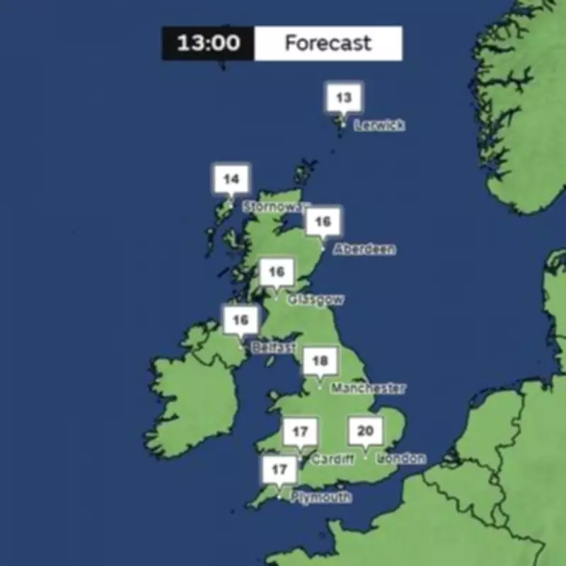
The United Kingdom has just experienced its hottest May day on record, with temperatures provisionally reaching 35 degrees Celsius at Heathrow and Kew Gardens in London. However, Met Office charts indicate that temperatures are poised to drop significantly next week, with forecasts showing a plunge to 20 degrees Celsius and below across the country.
Record-Breaking Heat
On Tuesday, temperatures provisionally climbed to 35C at Heathrow and Kew Gardens, the Met Office confirmed, following a blistering bank holiday weekend that saw the UK surpass its previous record for the warmest May temperature. On Monday, Kew Gardens reached 34.8C, eclipsing the earlier record of 32.8C established in 1922 and 1944.
Cooling Trend Expected
While temperatures are anticipated to steadily decrease from midweek, conditions will stay predominantly dry with periods of sunshine. Nevertheless, a more unsettled period is predicted from Sunday as Atlantic weather patterns advance from the west, delivering a combination of showers and extended periods of rainfall.
Wednesday is projected to stay dry for most areas, with peaks of approximately 26C in London. The north-east will experience cloudier conditions, with some brighter intervals emerging. In its forecast for Thursday through Saturday, the Met Office indicates conditions will continue hot throughout southern regions. It cautioned about the possibility of occasional thundery showers, before the weather becomes cloudier and cooler from the west approaching the weekend.
Extended Forecast
Its extended forecast for Sunday, May 31, through Tuesday, June 9, notes: "A more changeable period than we have seen of late, as Atlantic weather systems move in from the west to bring a mixture of drier spells and some showers, or longer spells of rain at times." The rain will likely be heaviest in parts of the west and northwest, with the best of the drier conditions more likely towards the south and east. Temperatures will be near-normal overall, with the warmest spots most likely across eastern areas. It will also be breezy at times, most especially across northwestern areas.
Temperature Drop Next Week
Met Office charts for next Tuesday (June 2) indicate a notable fall in temperatures, with southern England and Wales anticipated to experience highs in the late teens during the afternoon, while certain areas of the south-east may hit 20C. In contrast, northern England, Scotland and Northern Ireland are forecast to stay cooler, with temperatures lingering around the mid-teens.