The United Kingdom is preparing for a severe cold snap, with forecasters predicting temperatures will plummet to a biting -7C in the coming days. A surge of icy air from the Arctic is set to sweep across the nation, bringing the coldest weather so far this season.
The Cause of the Big Chill
This dramatic shift in the weather is linked to a major disruption of the Polar Vortex, triggered by an unusually early Sudden Stratospheric Warming (SSW) event. The polar vortex is a large area of low pressure and cold air that circles the Earth's poles. When it weakens or is disrupted, it can allow frigid Arctic air to spill southwards towards the UK.
These meteorological events are notorious for ushering in periods of exceptionally cold weather, including heavy snowfall, blizzards, and a sharp, sustained drop in temperatures.

When and Where the Mercury Will Drop
While the week has been characterised by mild but unsettled conditions, a significant change is expected as we head into the weekend and the second half of November. A strong area of high pressure is forecast to build, channelling those icy winds directly from the Arctic.
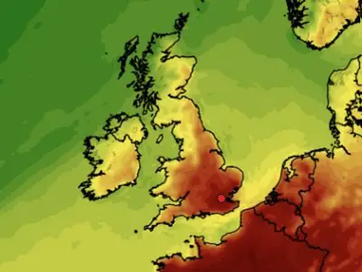
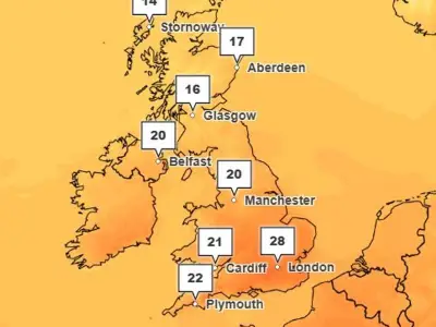
Weather maps from WXCharts illustrate the extent of the wintry blast. At the start of next week, temperatures across much of the UK will be near or below freezing. By Wednesday, Scotland could see lows of -7C, with northern England dropping to -3C and the south reaching around -2C.
The situation is primed for significant snow, as the incoming cold air is set to meet moisture-laden systems from the Atlantic. This collision creates the perfect recipe for snow to sweep across many parts of the country.
Official Forecast from the Met Office
The Met Office outlook confirms the arrival of colder conditions. Their forecast for the end of this week states: "By the weekend much of the UK will be under the cooler airmass with overnight frosts in places, and while there will still be some showers around it’ll be a much drier and brighter spell of weather."
Looking further ahead from November 16 to 25, the national weather agency predicts a continuation of the colder trend. They indicate that central and northern parts of the UK will likely experience colder, drier conditions with overnight frosts. Showers near windward coasts could turn wintry, especially over high ground in the north.
The Met Office summary adds: "It is most likely that the bulk of the UK will experience drier and colder conditions into the first part of next week." Later in the period, there is more uncertainty, but a trend towards changeable conditions is possible, with the potential for further rain, showers, and hill snow in the north.