Britain is bracing for a significant early winter blast, with fresh data suggesting the impending snow could be far more severe than initially anticipated.
Substantial Snowfall Projected for the North
According to the latest projections from WX Charts, which utilises Met Desk data, a dramatic downturn in conditions is likely around Saturday, November 22. The data, based on the GFS model, indicates that vast areas of northern Britain could be blanketed by a staggering 20 centimetres of snow.
This forecast is notably worse than earlier reports, which had suggested only a few centimetres were on the way. The heaviest accumulations are expected north of the border, with Scotland bearing the brunt of the wintry weather.

Regional Breakdown: Where Will See the Most Snow?
The projections paint a detailed picture of the potential disruptions. Edinburgh and the Scottish Highlands are among the areas that could see snow depths reaching the full 20cm mark.
Meanwhile, Inverness is forecast for around 16cm, with the capital city expecting approximately 5cm. The Cairngorms, a typical epicentre for severe winter weather, are predicted to be the worst impacted with the full 20cm flurries.
It's not just Scotland preparing for the white stuff. North Wales, particularly Snowdonia, could see several centimetres accumulate, and Northern Ireland is also likely to receive a light dusting. For much of England, however, a widespread soaking of rain is expected instead of snow as December approaches.
Meteorological Debate and Short-Term Outlook
Despite the compelling data from WX Charts, a note of caution has been introduced by other forecasters. Both The Met Office and BBC Weather teams are reportedly not yet convinced that the UK will see significant snow from this system.
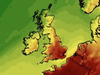
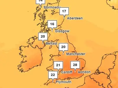
In the immediate short term, the UK is experiencing unseasonably mild conditions. Netweather TV's meteorologists confirmed that temperatures reached 19C in Plymouth, Devon recently, well above the average high of 12C for this time of year.
The weekend ahead is expected to remain on the mild side, with a southwesterly flow bringing cloud and moisture. Saturday is predicted to be the better day, with dry spells and sunshine developing for many after a damp start.