
The city of Birmingham is on alert for a rare and hazardous weather phenomenon expected to strike in the early hours of Sunday, January 11, 2026. Forecasters warn of freezing rain, an event seldom seen in the UK, which will cap off a week already disrupted by wintry conditions and Storm Goretti.
What is Freezing Rain and Why is it So Dangerous?
Freezing rain is considered far more perilous than ordinary snow or rainfall. It occurs when snowflakes melt into raindrops as they fall through a layer of warm air, only to enter a deep freeze of sub-zero temperatures just above the ground. This process supercools the liquid droplets, keeping them in a liquid state below 0°C until they hit a cold surface.
Upon impact with the ground, roads, pavements, or any exposed object, these supercooled droplets freeze instantly into a clear glaze of ice, commonly known as black ice. This ice can be several centimetres thick, is incredibly slippery, and is notoriously difficult to see, effectively transforming the city into an ice rink.

Timeline of the Weekend Weather Event
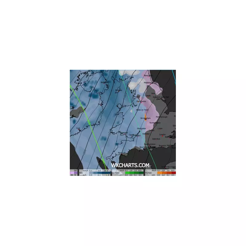
The dangerous conditions are set to begin as temperatures in Birmingham are forecast to plunge to -2°C by midnight on Sunday. Weather maps from WX Charts indicate the freezing rain will manifest as an orange patch over the city around 3:00 am.
Following this icy onslaught, a further 0.6cm blanket of snow is predicted to fall at approximately 9:00 am on Sunday. While this accumulation is light, it will compound the travel hazards created by the earlier, invisible ice.
Widespread Disruption and Met Office Warnings
The Met Office has issued stark warnings about the potential impacts. The weight of the ice accretion can be heavy enough to bring down trees and overhead power lines, causing localised power cuts. The hazard to aviation is also severe, with ice capable of building up rapidly on aircraft wings and control surfaces—a factor that contributed to significant disruption at Birmingham Airport earlier in the week due to Storm Goretti.
As Sunday progresses, wet and windy weather is expected to move eastwards across the region. However, residents can expect some respite with a milder trend forecast to begin on Monday, January 12. Temperatures are predicted to recover across all regions into Tuesday, bringing an end to this intense cold snap.
Authorities are urging the public to exercise extreme caution, avoid non-essential travel during the warning period, and be prepared for potential disruptions to transport and power supplies.


