Weather experts have issued a stark warning for a significant 'snow bomb' set to hit the United Kingdom, with a specific date now identified for the onset of severe wintry conditions.
Arctic Blast Set to Trigger Widespread Disruption
Meteorological data indicates that a freezing Arctic plume is on course to sweep across the British Isles, bringing with it heavy snowfall and temperatures plunging well below zero. The most intense period of this cold snap is currently forecast to begin around 16th January.
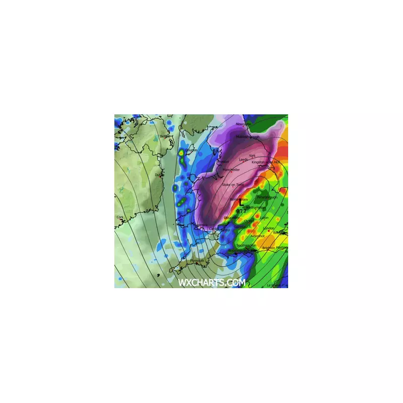
Forecasters analysing charts from WXCharts predict the system will deliver substantial snow accumulations, particularly across northern and central regions. Some parts of Scotland and northern England could see up to 25cm of snow as the weather front pushes southwards.

Regions on High Alert for Hazardous Conditions
The impending Arctic blast has placed multiple regions on high alert. While the north is braced for the heaviest falls, the Midlands and parts of southern England are also expected to experience wintry showers and icy conditions.
Authorities have warned that the sudden shift in weather is likely to create hazardous travel conditions on major roads and motorways. Commuters are being urged to plan ahead and stay updated with the latest alerts from the Met Office as the event approaches.
The cold air is predicted to settle over the country for several consecutive days. This prolonged cold snap is anticipated to strain infrastructure, placing extra demand on the National Grid for power and increasing pressure on local heating supplies.
Public Health Advice for the Deep Freeze
In response to the forecast, public health officials are advising residents, especially the elderly and vulnerable, to take precautions. Recommendations include preparing homes for the sharp temperature drop and aiming to maintain key living spaces at a minimum of 18°C to mitigate health risks associated with extreme cold.
While the precise track of the low-pressure system may still shift slightly, the current consensus among forecasters points to a high probability of disruptive, wintry weather. The public is advised to monitor official forecasts closely in the coming days for any updates to warnings.