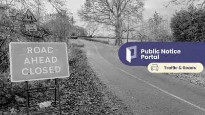
Weather maps are indicating a dramatic shift towards wintry conditions across the United Kingdom, with a colossal 363-mile wall of snow and blizzards predicted to impact major urban centres, including Birmingham. The latter half of January is set to see temperatures plunge below freezing as this significant weather system moves in.
A Major Snow Front on the Horizon
According to data from WXCharts.com, a substantial weather front is expected to sweep in from the Atlantic Ocean around January 27th. This system will initially affect Wales and the South West of England before progressing inland. By January 29th, forecasts suggest the snow front will span an impressive distance from Glasgow all the way down to the South Coast.
Regional Impacts and Snowfall Depths
The anticipated snowfall is projected to be most severe in Scotland, where some areas could see accumulations as deep as 63 centimetres. Cities like Aberdeen, Dundee, and Edinburgh are all forecast to receive in excess of 25cm of snow, which is likely to cause significant disruption.

Further south, Wales is also bracing for considerable snowfall, with around 10cm predicted in some regions. Major English cities are not expected to be spared, with Newcastle, Manchester, Birmingham, and London all in line to be impacted by the wintry blast. The snow will be accompanied by bitterly cold temperatures, potentially dropping as low as -6°C, meaning much of Britain will wake up to sub-zero conditions on the morning of January 29th.
Met Office Forecast Supports Wintry Outlook
The Met Office's long-range forecast for the period of January 23rd to February 1st supports the possibility of this colder, snowier spell. Their outlook indicates that temperatures are likely to be around or slightly above average for most, except in the far North-east where colder conditions with some sleet or snow are more probable.
The forecast states: "There is then an increased chance that conditions will turn more widely colder and drier. This aspect of the forecast is still somewhat uncertain but the potential transition to colder weather also increases the chance of snow across parts of the country."
Forecasting Challenges and Colder Air Battle
The agency warns that temperatures are expected to turn colder from the coming weekend. This change is due to a meteorological battle, with Atlantic weather systems attempting to push wet and windy conditions from the west, while high pressure brings colder, drier air from the east.
Met Office Deputy Chief Forecaster Steven Keates provided further insight, noting: "While it does look increasingly likely that conditions will turn more widely colder into next week, the timing and extent of this colder air remains uncertain. There are variations between the different weather models, and although a few show very low temperature values, this is currently the minority. The majority indicate below-average temperatures from the east, but nothing too extreme at the moment."
The Met Office often cautions that predicting snow more than a few days ahead is inherently difficult. They explain that in temperate climates like the UK's, even a small amount of snow can cause widespread disruption, but forecasting it accurately is challenging. Numerous factors, including elevation, distance from the coast, and precipitation intensity, all play a crucial role in determining whether rain or snow will fall.