
Birmingham and large swathes of the United Kingdom are bracing for another bout of wintry weather later this month, according to advanced meteorological projections.
Significant Snowfall Expected Across the UK
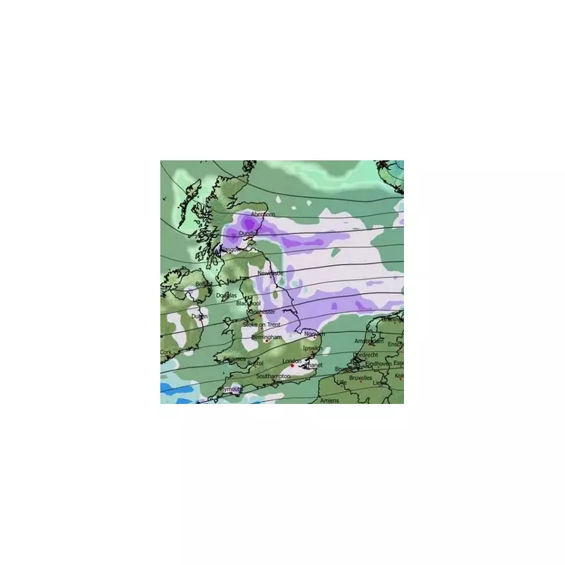
The GFS weather model indicates a major weather front will sweep across the UK from the East, arriving around January 23. This system is forecast to bring snowfall that will persist through January 24, affecting not only Birmingham but also Wales and Northern Ireland extensively.
Forecast maps suggest a widespread covering of snow will be visible across numerous major cities. Alongside Birmingham, the list includes London, Bristol, Cardiff, Nottingham, Norwich, Manchester, Newcastle, Edinburgh, Glasgow, Dundee, and Aberdeen.

Projected Snow Depths and Storm Severity
Current data predicts that snow accumulation will vary significantly by region. Birmingham is expected to see around one inch of settling snow. Northern England could receive up to two inches, while parts of Scotland may be hit hardest with accumulations potentially reaching eight inches in some areas.
Meteorologists have provided some reassurance, noting that this incoming storm is not anticipated to be as severe as the historic 'Beast from the East' which caused widespread disruption in 2018.
Long-Range Forecast and Meteorological Context
The BBC's long-range forecast for the period of January 19 to 25 tempers expectations for some areas. It states: "The chance of any meaningful snowfall is low, but some wintry showers are possible in northern regions, chiefly in Scotland, in fleeting chillier and brighter spells between weather systems. For most areas, precipitation amounts will be near or above normal, with a further thaw of any remaining snow."
Looking further ahead to January 26 through February 8, the forecast suggests a prevailing pattern of milder, Atlantic-driven weather. The outlook explains: "The broad circulation pattern should linger... with mild west to south-westerly winds often present, and Atlantic low pressure systems bringing further bouts of wet and windy weather."
It adds that any colder interludes should be short-lived, primarily confined to the north, with wintry showers likely only on Scotland's uplands. The overall temperature is predicted to average above normal for the time of year.
However, forecasters caution about inherent uncertainties in long-range modelling. There are tentative suggestions of high pressure developing at higher latitudes, possibly over Scandinavia. Should this occur more strongly, it could open the door to colder flows from the east, a scenario that experts say warrants monitoring, even if it is not currently the most probable outcome.


