Weather maps from WXCHARTS indicate that a significant cold snap is set to sweep across the United Kingdom, with snowfall forecast to affect the Midlands and other regions from Friday, 13 February through to Tuesday, 17 February 2026. This follows recent wintry conditions that have already blanketed parts of the country earlier in the year, signalling a prolonged period of harsh winter weather.
Detailed Snowfall Predictions and Timing
The latest weather charts reveal that snow is expected to commence on Friday, with Scotland potentially experiencing the heaviest accumulations, reaching up to 51 inches in some areas. By 6am on that day, snowfall rates could peak at 20mm per hour, impacting north Wales, the Midlands, and the East of England. This intense precipitation is likely to cause disruptions to travel and daily activities in these regions.
Temperature Drops and Cold Front Movement
On Sunday, 15 February, at 6am, a cold front is projected to move across Britain, bringing freezing temperatures nationwide. Weather maps display freezing blue tones, indicating temperatures ranging from 0°C to -3°C across most of the UK. Only the very southern tip of Cornwall might see marginally milder conditions, around 8°C, offering a brief respite from the chill.

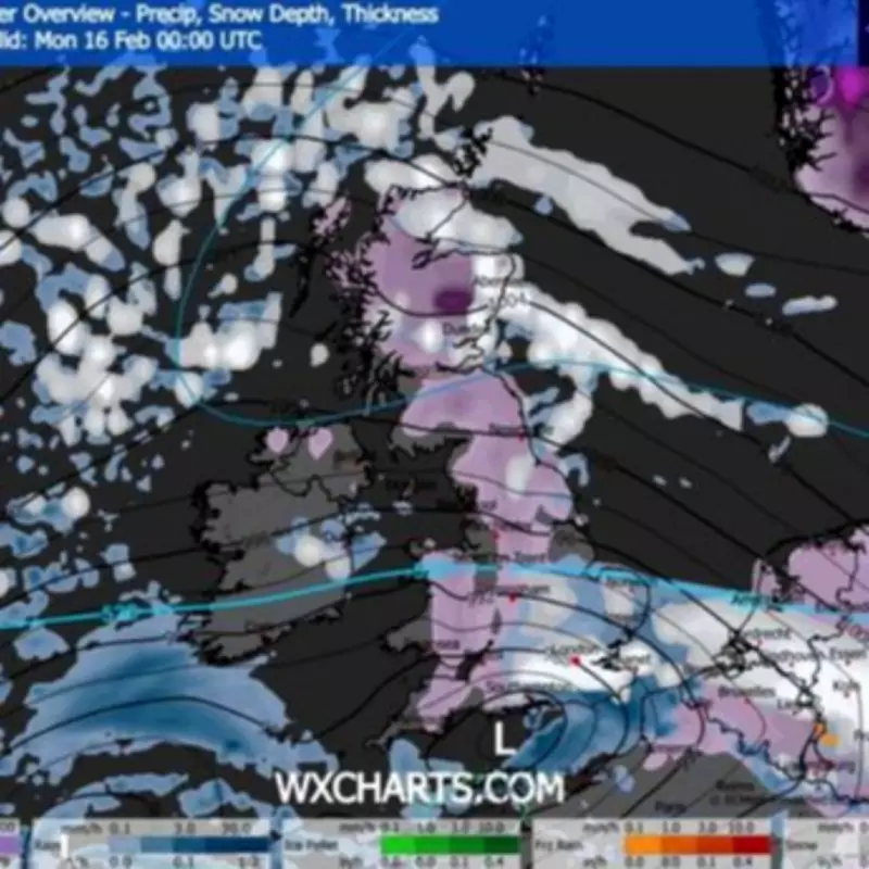
Valentine's Day and Beyond: Weather Patterns
Valentine's Day might provide a temporary break from the severe weather, though scattered rain and snow are still anticipated, mainly across Scotland and Wales. However, by midnight on Monday, 16 February, substantial portions of the nation are expected to be covered in snow, with charts showing nearly all of the UK draped in purple, indicating widespread snowfall. This extends from the Scottish Highlands right down to Plymouth, with very few areas remaining unaffected.
Met Office Insights and Forecast Challenges
By Tuesday, 17 February, the snow is anticipated to push as far south as the Midlands, while southern England looks set to remain drier. The Met Office has issued a warning, noting that predicting snowfall remains notoriously difficult due to variable atmospheric conditions. Their forecast states: "Predominantly cyclonic patterns are expected to dominate the UK. The early part of this period could see colder conditions becoming established more widely for a time, bringing with it the likelihood of some snow. Milder and wetter weather may however hang on in the far south. By the end of this period, the track of Atlantic depressions may shift a little further north than during the last few weeks."
Residents in the Midlands and other affected areas are advised to prepare for potential travel delays, school closures, and increased heating needs as this cold snap approaches. Keeping updated with local weather reports and following safety guidelines during snowy conditions is crucial to minimise risks and ensure community well-being.