
The West Midlands is set for a frosty start to the New Year as the Met Office issues new weather maps predicting the arrival of snow and ice. Forecasters warn that temperatures will plunge below freezing, with a significant risk of wintry showers sweeping across the region by the weekend.
Detailed Forecast: From Frost to Snow Showers
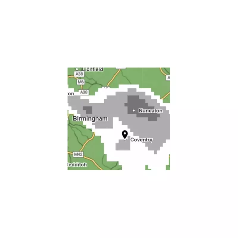
According to the latest Met Office data, temperatures in the West Midlands are expected to drop sharply over the next 48 hours. The colour-coded snow map indicates a band of grey and white moving into the area, which includes Birmingham. The white zones on the map highlight the locations most likely to experience the heaviest snowfall.
Tonight, temperatures will fall to a chilly -2°C, creating a widespread frost and potential patches of freezing fog after a largely fine day. This will lead to a cold and frosty beginning to New Year's Eve on Wednesday, despite plenty of winter sunshine. The maximum temperature on Wednesday is forecast to be just 5°C.

Weekend Outlook: Increased Risk of Wintry Weather
The outlook from Thursday through Saturday suggests a turn towards more unsettled conditions. New Year's Day will see cloudier skies with showery rain arriving. The situation is then expected to become notably colder, particularly in the wind, with an increased risk of wintry showers into the weekend.
Forecasters have indicated a 30 per cent chance of rain and snow in the early hours of Saturday, January 3rd. Sub-zero temperatures are predicted to remain consistent throughout the weekend, with overnight frost and ice posing ongoing hazards.
Staying Safe in the Cold Snap
With risk alerts for snow and ice in place across the UK, residents in the West Midlands are advised to prepare for potentially hazardous travel conditions. The combination of freezing temperatures, frost, and possible snow showers requires extra caution on roads and pavements. The Met Office emphasises staying updated with the latest local forecasts as the situation develops.


