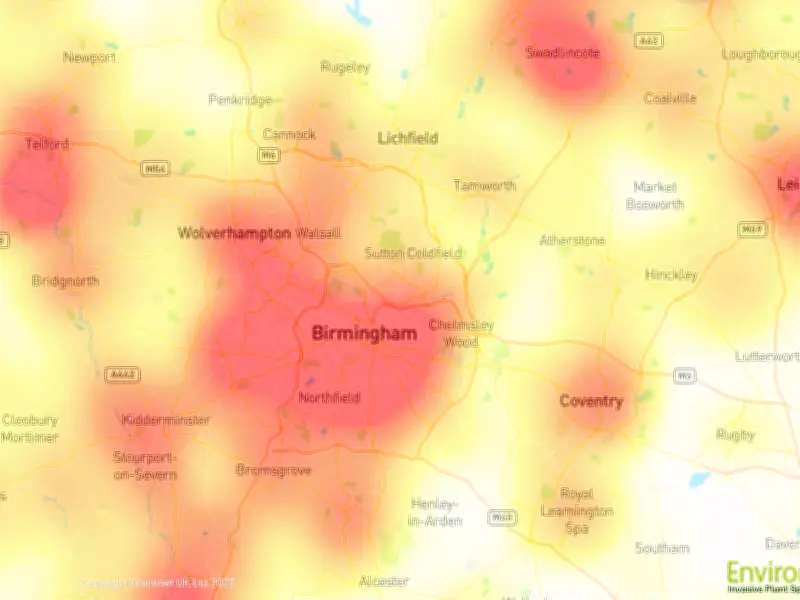
A new map from Environet has identified the Japanese knotweed hotspots across the West Midlands, with Birmingham recording more than 300 sightings in 2026. The invasive plant can damage buildings, hinder property sales, and lead to legal disputes, potentially reducing house prices by over £13,000.
West Midlands Top 10 Hotspots
Birmingham tops the list with 320 sightings, more than four times the second-worst area, Walsall (74). Other hotspots include Solihull (60), Wolverhampton (54), Dudley (53), Halesowen (40), Oldbury (27), West Bromwich (19), Smethwick (15), and Tipton (11). Overall, the West Midlands ranks 13th worst in the UK with 693 verified sightings, equivalent to 2.23 incidents per square mile.
Impact on Property Values
Research by Environet in partnership with Censuswide in 2026 indicates that 7% of UK homes—over 1.58 million properties—are affected by Japanese knotweed. Property values typically drop by around 5%, averaging £13,500 per home. After ash dieback disease, Japanese knotweed is the UK's second most costly invasive non-native species, with an estimated £246.5 million in annual economic costs, according to CABI.
Identification and Advice
Environet Director Emily Grant said: “Japanese knotweed is now firmly established right across the country, which means homeowners everywhere should know what to look for. My advice to anyone living or buying a home in a Japanese knotweed hotspot is to check your garden regularly during the growing season. At this time of year, an established knotweed plant can be identified quite easily by its hard bamboo-like canes and distinctive bright green shield-shaped leaves which grow in a zig-zag pattern along the stem. The earlier it’s spotted, the easier and cheaper it is to deal with. Acting quickly with professional advice will prevent it spreading further and help protect both your property and its value.”
Online Heatmap and Free Identification
Environet's online tracker, Exposed: The Japanese Knotweed Heatmap, allows homeowners and buyers to check their postcode for risk levels. Anyone suspecting knotweed can email a photo to expert@environetuk.com for free identification. If confirmed, a survey will determine the extent of infestation and treatment options. The heatmap incorporates data from Environet, public reports, and sources like the National Trust, Natural England, RHS, and Wildlife Trusts. Apparent increases in sightings may reflect new datasets rather than genuine spread.