The Met Office has escalated weather concerns by issuing a significant yellow weather warning for large parts of the UK, forecasting a weekend of heavy rain and gusty winds that are expected to cause widespread travel disruption.
Weekend Weather System Details
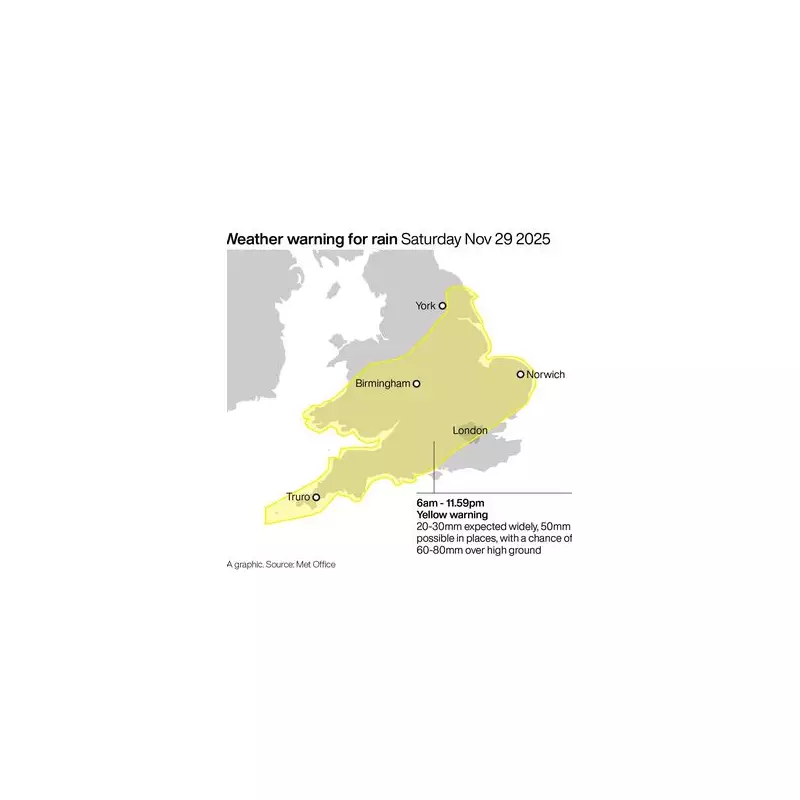
Forecasters indicate that a deep area of low pressure is poised to sweep across southern and central regions of the UK on Saturday. This system will bring bands of heavy rain and gusty winds, with the most intense conditions anticipated for Wales, the Midlands, and southern England.
Substantial rainfall totals are predicted, with 20-30mm expected widely across England and Wales. Some areas could see significantly higher amounts, potentially reaching up to 50mm. On higher ground, there is a small chance of deluges between 60 to 80mm.

Potential Impacts and Expert Commentary
Jason Kelly, the Chief Meteorologist at the Met Office, provided a detailed assessment. "While the exact track of the low remains uncertain at this time, there is a clear signal for strong winds and periods of heavy rain, which could lead to surface water flooding and delays to road and rail travel," he stated.
He also highlighted a notable shift for north-east England, where the rain could turn to snow over higher ground as the system collides with colder air from the north.
The Met Office has outlined several potential consequences for the public:
- Challenging driving conditions and potential road closures due to flooding.
- Delays and cancellations to rail and bus services.
- A possibility that some communities could become temporarily isolated by flooded roads.
- A slight risk of power cuts and disruptions to other essential services.
Looking Further Ahead
A brief respite is expected on Sunday, which will be drier, brighter, but noticeably colder for many, with blustery winds continuing near North Sea coasts. A widespread frost is forecast overnight into Monday.
However, the unsettled conditions are set to return swiftly. Another powerful Atlantic system is predicted to sweep in from the South West at the end of the weekend, bringing further downpours. The most intense rain from this second system is expected in parts of south and south-west England and South Wales, accompanied by powerful winds that may reach gale force along exposed coastlines.
A Met Office spokesperson confirmed that forecasts are being closely monitored and will be updated as the situation develops. They advise residents to assess their flood risk and consider preparing a flood plan and an emergency kit.