
Midland Counties Among Dozens Set for 20C-Plus April Temperatures
The latest weather forecasting maps reveal that temperatures in Midland counties and across southern England could soon soar to 20C and above, with some areas potentially experiencing highs of up to 23C later this month.
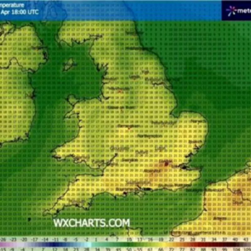
Significant Heat Surge Predicted for Late April
According to the ECMWF weather model, Britons are in line for a significant heat surge towards the end of April. The data suggests that the mercury could climb as high as 23C in certain regions, marking a notable warm spell for this time of year.
The forecasting maps indicate that temperatures will peak across the south-east of England and along the south coast on April 29, around 6pm. Warm conditions are also anticipated in East Anglia, the Midlands, and parts of Wales, providing a pleasant respite from typical spring weather.

Widespread Warmth Across the UK
Further north, temperatures are not expected to be particularly chilly either. The ECMWF model points to highs of 18C in Northern Ireland and southern parts of Scotland, with the Scottish Highlands potentially reaching 16C. However, it is the more southerly regions that will enjoy the most glorious warmth.
Reports from the Express and Mirror highlight that 28 counties in England could record temperatures of 20C or higher on April 29. The full list includes:
- Staffordshire
- Warwickshire
- Worcestershire
- Gloucestershire
- Cornwall
- Devon
- Somerset
- Dorset
- Wiltshire
- Berkshire
- Oxfordshire
- Hampshire
- Sussex
- Surrey
- Kent
- Middlesex
- Essex
- Hertfordshire
- Buckinghamshire
- Bedfordshire
- Cambridgeshire
- Norfolk
- Suffolk
Met Office Warnings and Long-Term Forecast
Despite the predicted warmth, the Met Office has issued warnings that parts of the country could still experience some cold air and wintry showers. Their outlook from April 22 to May 1 states that high pressure is likely to remain centred to the north or northwest of the UK for much of this period amid slowly evolving weather patterns.
This means overall, a fair amount of dry weather is expected, though there will likely be some exceptions. Atlantic frontal zones may graze over the southwest near the start of this period, bringing some rain and breezy conditions.
The latter part of April may also see cold air sweep south across much or all of the UK for a time, bringing potential for wintry showers in the north and east and more widespread overnight frost. Any cold spell looks fairly likely to be short-lived before somewhat milder conditions become re-established.
Early May Predictions
The Met Office has also revealed its predictions for early May. The forecast covering May 2 to May 18 states that slowly evolving weather patterns are likely to continue throughout the first half of May. Within this, high pressure is more likely than not to be located somewhere to the north or northwest of the country, and low pressure located closer to southern areas.
The orientation of and proximity to the UK of each of these features will be key to regional weather on a day-to-day basis. However, on balance, northern and some western areas would likely be drier, with southern and possibly some eastern parts seeing more in the way of rain or showers at times.
Overall, temperatures are probably close to or a little above average, though there is scope for some chilly nights with late season frost, especially in the north.


