The Midlands could face scorching 38C temperatures by July 11, according to the latest GFS weather model maps, as another intense heatwave threatens to follow the current record-breaking spell.
Record-Breaking June Heat
Yesterday marked the hottest day of the year and the most scorching June day ever recorded in the UK, with the mercury hitting 37.3C in Santon Downham. While Birmingham is now slowly cooling down, the Met Office predicts temperatures will fall below 30C in the south by Monday, June 28. In the West Midlands, the heatwave is expected to ease earlier on Sunday, June 28, with highs of 23C – more than 10C lower than recent days.
Next Heatwave Predicted for July
But another blistering heatwave could be just days away. The GFS weather model suggests a four-day heatwave beginning on July 8, with the Midlands potentially being one of the hottest areas. Temperatures are predicted to climb to 33C in southern and western areas on July 8, rising to 36C near London and 35C widely across southern and eastern England on July 9.

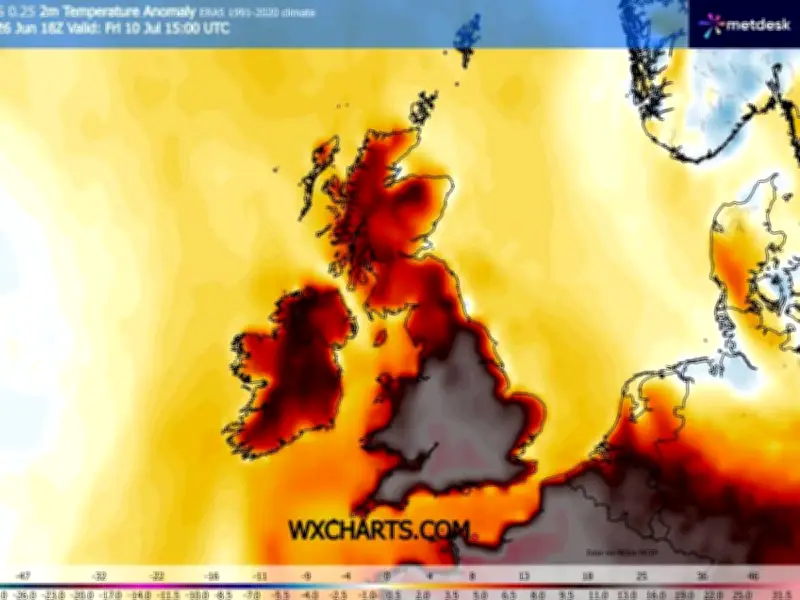
Peak Temperatures on July 10 and 11
Searing highs of 38C are expected on July 10, with western England and the south bearing the most intense conditions. On July 11, temperatures could again climb to 38C across the north-west, Midlands, Yorkshire, and the south-east. In total, GFS maps indicate that 17 counties – all in England – could hit 38C or higher.
The affected counties include: Yorkshire, Cheshire, Staffordshire, Derbyshire, Leicestershire, Warwickshire, Northamptonshire, Shropshire, Gloucestershire, Worcestershire, Wiltshire, Berkshire, Oxfordshire, Buckinghamshire, Surrey, Sussex, and Kent.
Met Office Outlook
The Met Office has already indicated a greater than normal chance of hot conditions in July. Its forecast covering July 11 to 25 states: "High pressure patterns are looking slightly more likely than low pressure patterns during the early part of this period, meaning a greater chance of settled and drier than average conditions. Although with outbreaks of rain and stronger winds at times, more especially across the north. There is still a chance of some changeable or more unsettled conditions developing later in the period, with a risk of some heavy and thundery showers. Temperatures are likely to be above normal on the whole, with a greater than normal chance of hot conditions developing at times."