
A substantial new weather system is poised to deliver widespread snowfall across extensive regions of England, with the Midlands expected to bear the brunt of the incoming winter blast. Latest meteorological projections indicate a formidable wall of snow advancing toward the UK, scheduled to make landfall on Monday, February 16.
Forecast Details and Expected Impact
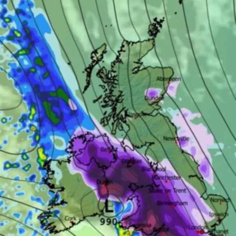
Residents across numerous Midlands towns and cities could awaken to significant accumulations of the white stuff on that date. Weather maps for 6am on February 16 illustrate the snow system enveloping the entirety of the Midlands and Wales, while also extending across much of southern England.
Specific Areas Anticipating Snowfall
The forecast specifically identifies several major urban centres within the Midlands region that are likely to experience this snowfall event:

- Birmingham
- Wolverhampton
- Stoke-on-Trent
- Coventry
- Leicester
- Nottingham
Official Meteorological Assessment
The Met Office has confirmed that some snow is likely in parts of the country during this period. Their official forecast for February 10 through 16 outlines a predominantly cyclonic pattern expected to dominate UK weather systems.
The meteorological service explains that further fronts are likely to approach the UK at intervals, becoming slow-moving as they encounter high-pressure systems positioned to the north or northeast of the country. This atmospheric configuration means southern and western areas remain particularly vulnerable to persistent wet conditions, maintaining sensitivity to potential flooding impacts.
Broader Weather Patterns and Risks
Parts of northeast Britain may also experience wetter than normal conditions during this period. The Met Office specifically notes that snowfall is especially probable in two scenarios:
- Within any colder air masses that filter south or east into the UK
- Along the interface between mild and cold air masses
The forecast also indicates that strong winds are possible at times, adding to potential disruption. Temperature distributions will remain delicately balanced throughout this period, with northeastern areas more likely to experience colder than average conditions, while southwestern regions might see intermittent mild spells.
This developing weather situation requires monitoring as the February 16 date approaches, with residents across the identified Midlands areas advised to stay updated with the latest forecasts and travel information.


