
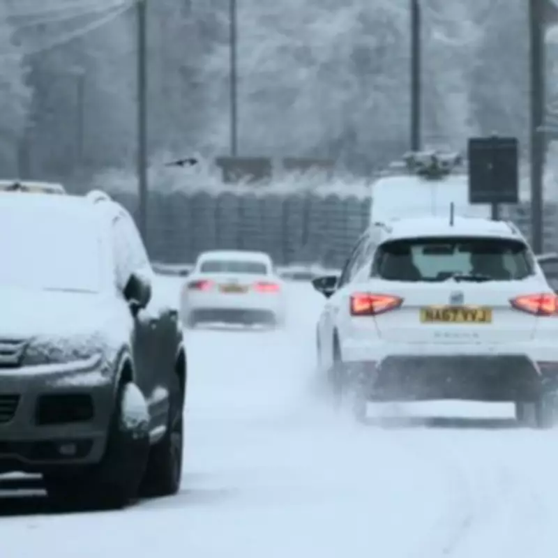
Met Office Forecasts Widespread Snow Across Entire UK This Weekend
The Met Office has issued two separate yellow weather warnings for snow and ice, predicting wintry conditions that will affect all 61 regions of the United Kingdom over the coming weekend. This extensive alert system underscores the severity of the impending weather front, which is expected to bring significant snowfall to many areas.
Timeline of the Weather Warnings
The first yellow warning for snow and ice came into effect at 4:00 PM on Friday, February 13, and will remain active until 10:00 AM on Saturday, February 14. This initial alert primarily targets northern England and Scotland, where snowfall is anticipated to be most intense during the early hours of Saturday.
A second yellow warning for snow and ice will be implemented from 9:00 PM on Saturday, February 14, through 10:00 AM on Sunday, February 15. This follow-up alert expands the affected areas, bringing wintry conditions to a broader swath of the country, including the Midlands and parts of southern Scotland.

Expert Forecast and Public Advisory
Met Office chief forecaster Rebekah Hicks provided detailed insights into the expected weather patterns. "Snow is likely ahead of the rain across northern England and Scotland and could reach lower levels at times Saturday night into Sunday," she stated. "The snow will gradually turn to rain as the front moves east across the country on Sunday. The rain may be heavy at times and it will be windy in coastal areas."
Hicks further cautioned that additional warnings may be necessary as the situation develops. "We encourage the public to keep up to date with the latest forecasts and any warnings that may be issued," she advised, highlighting the importance of staying informed during this volatile weather period.
Regions Affected by the First Warning
- Central, Tayside & Fife: Angus, Perth and Kinross
- Grampian: Aberdeen, Aberdeenshire, Moray
- Highlands & Eilean Siar: Na h-Eileanan Siar, Highland
- North East England: Darlington, Durham, Gateshead, Hartlepool, Middlesbrough, Newcastle upon Tyne, North Tyneside, Northumberland, Redcar and Cleveland, South Tyneside, Stockton-on-Tees, Sunderland
- Orkney & Shetland: Orkney Islands, Shetland Islands
- Yorkshire & Humber: East Riding of Yorkshire, Kingston upon Hull, North Lincolnshire, North Yorkshire
Regions Affected by the Second Warning
- Central, Tayside & Fife: Angus, Clackmannanshire, Dundee, Falkirk, Fife, Perth and Kinross, Stirling
- East Midlands: Derby, Derbyshire, Nottingham, Nottinghamshire
- Grampian: Aberdeen, Aberdeenshire, Moray
- Highlands & Eilean Siar: Highland
- North East England: Darlington, Durham, Gateshead, Hartlepool, Middlesbrough, Newcastle upon Tyne, North Tyneside, Northumberland, Redcar and Cleveland, South Tyneside, Stockton-on-Tees, Sunderland
- North West England: Blackburn with Darwen, Cheshire East, Cumbria, Greater Manchester, Lancashire
- SW Scotland, Lothian Borders: Dumfries and Galloway, East Lothian, Edinburgh, Midlothian Council, Scottish Borders, West Lothian
- Strathclyde: Argyll and Bute, East Ayrshire, East Dunbartonshire, East Renfrewshire, Glasgow, Inverclyde, North Ayrshire, North Lanarkshire, Renfrewshire, South Ayrshire, South Lanarkshire, West Dunbartonshire
- West Midlands: Staffordshire, Stoke-on-Trent
- Yorkshire & Humber: East Riding of Yorkshire, North Yorkshire, South Yorkshire, West Yorkshire
The comprehensive nature of these warnings indicates that virtually no part of the UK will be spared from the wintry blast. Residents across the country are urged to prepare for potential travel disruptions, hazardous road conditions, and possible power outages as the snow accumulates.

Local authorities in the affected regions are likely to implement gritting schedules and emergency response plans to mitigate the impact of the severe weather. The Met Office continues to monitor the situation closely and will issue updates as necessary to ensure public safety during this challenging weather event.


