The Met Office has issued a stark warning for 37 specific parts of England, forecasting snow every day until Saturday as a major winter system dubbed Storm Goretti sweeps across the country. The forecaster warns of significant disruption to travel and daily life.
Widespread Disruption Expected
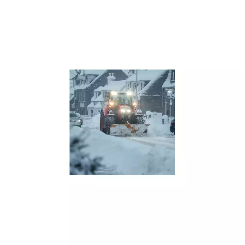
Residents across a large swathe of England should prepare for difficult conditions. The Met Office states there is a high likelihood of travel delays on roads, with the potential for some vehicles and passengers to become stranded. Rail and air travellers are also warned to expect possible delays and cancellations.
The impact could extend beyond transport. "Some rural communities could become cut off," the alert adds. Power cuts may occur and other essential services, including mobile phone coverage, could be affected by the heavy snow.

Storm Goretti's Path and Weather Warnings
A series of yellow weather warnings for snow and ice are now in effect. They began on Wednesday, January 7, 2026, and will remain through Thursday, January 8, Friday, January 9, and Saturday, January 10.
According to forecasters, a weak ridge of high pressure will bring a brief, drier interlude on Wednesday, but it will remain very cold. The main event, Storm Goretti, is a developing low-pressure system set to cross southern UK on Thursday.
This storm will initially bring rain before transitioning to accumulating snow across much of southern England later on Thursday and overnight. Strengthening winds will create hazardous conditions. The BBC Weather team notes a "fine line between snow and rain" due to temperatures hovering near freezing, with the far south and southwest more likely to see a wintry mix.
Areas Under the Snow Warning
The Met Office has named the following 37 local authority areas and counties that are expected to see snow daily through Saturday:
- Derby
- Derbyshire
- Leicester
- Leicestershire
- Lincolnshire
- Northamptonshire
- Nottingham
- Nottinghamshire
- Rutland
- Bedford
- Cambridgeshire
- Central Bedfordshire
- Hertfordshire
- Luton
- Peterborough
- Buckinghamshire
- Milton Keynes
- Oxfordshire
- West Berkshire
- Cheshire East
- Bath and North East Somerset
- Bristol
- Gloucestershire
- North Somerset
- Somerset
- South Gloucestershire
- Swindon
- Wiltshire
- Herefordshire
- Shropshire
- Staffordshire
- Stoke-on-Trent
- Telford and Wrekin
- Warwickshire
- West Midlands Conurbation
- Worcestershire
- South Yorkshire
The northern half of the UK will experience cold but drier weather with only scattered wintry showers. After the snow clears eastern England early Friday, a transient high-pressure ridge should bring drier, brighter conditions for Saturday, though it will remain colder than average.
However, forecasters are already monitoring another Atlantic frontal system that could bring further snow, potentially heavy, to northern and eastern areas later in the weekend, accompanied by strengthening winds.