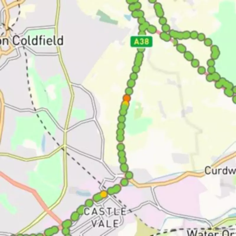
Parts of the A38 in Sutton Coldfield have been flagged as 'unhealthy' by a rival app to Google Maps. The AI-powered app, Stan The App, has recorded yellow and orange health scores for sections between Minworth Island and the M6 Toll junction.
How the App Works
The app allows drivers to record road footage, which is then processed to generate health scores. It scans for potholes, cracks, and pooling water using computer vision technology. Road health is rated on a five-point scale from dark red to green.
Affected Areas
Areas near Wishaw Golf Club and Bulls Lane have been marked with concerning yellow and orange ratings. While most of the A38 shows green scores, the highest possible, these sections indicate potential road defects.

A spokesperson for Stan the App said: "Stan the App utilises cutting-edge computer vision technology to identify road defects, such as potholes, with remarkable accuracy."
Previous Tests
BirminghamLive previously tested the app in May 2024 across urban and rural roads. The app showed better scores for roads in north Wolverhampton compared to smaller county roads near Staffordshire.
For the full story, visit the original article on BirminghamLive.