
Met Office Issues Extensive Snow Warning for Monday Across UK
The Met Office has released a detailed forecast indicating the return of significant snowfall to the United Kingdom on Monday, January 26. Weather maps from the national meteorological service reveal a substantial snow event spanning an impressive 459 miles, affecting numerous regions from the Midlands to northern Scotland.
Timeline of Snowfall Across the Nation
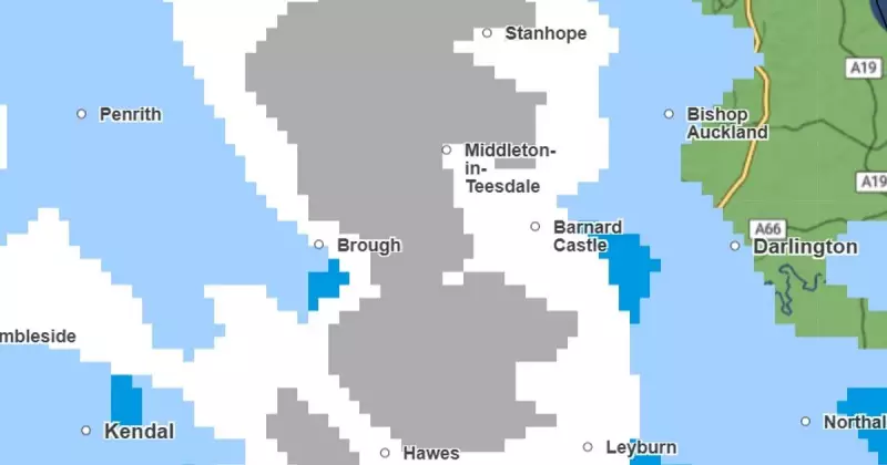
According to the latest meteorological data, isolated snow flurries will commence in the early hours of Monday morning. At approximately 1am, initial snowfall is anticipated in Cumbria, with Penrith highlighted as a primary location. By 4am, the precipitation is expected to extend into Lancashire, impacting areas including Preston, with scattered flurries also possible across parts of Greater Manchester.
Progressing through the morning to around 6.30am, the snowfall is forecast to reach Yorkshire, particularly affecting Whitby. Simultaneously, northern regions such as Durham and Northumberland are also projected to experience snow accumulation during this period.

Midday and Afternoon Snow Coverage
By midday on Monday, the snow is predicted to extend into North Wales, with Caernarfon, Wrexham, and Newtown identified as areas at risk. Aberystwyth may also encounter flurries during this timeframe. As the afternoon progresses, Cheshire and Staffordshire could see snowfall by 1pm.
Further north, by 3pm, the Highlands are expected to experience significant snow coverage. The meteorological maps indicate extensive white blobs expanding across the region, encompassing areas between Craig in the west, Aberlour in the east, and Loch Rannoch. This development suggests that Fort William, Pitlochry, and Strathyre are all likely to receive a dusting of snow.
Evening Snowfall and Meteorological Analysis
Into the evening hours, by 10pm, a substantial portion of the North West of England is forecast to face snow coverage. The weather maps display a slice of white and grey, symbolising snowfall, stretching from Newcastle down to Manchester. Additionally, the tip of Staffordshire, notably Stoke, is speculated to be covered.
Meteorological expert Ian Simpson from Netweather TV provided insight into the weather patterns driving this event. He explained, "Cold air outbreaks over Canada and North America are powering up the jet stream. As is often the case in these situations, major cold air outbreaks over Canada and North America are helping to power up the jet stream and send deep lows our way."
Simpson further elaborated on the atmospheric conditions, noting, "Much of Canada has been under a very cold air mass for some time, and a lot of this cold air has recently headed into the north and east of North America, where it is forecast to stick around for about a week, though the cold is expected to subside considerably in a week's time, especially over Canada, where most areas are forecast to switch to being considerably warmer than average."
This comprehensive forecast underscores the widespread nature of the impending snow event, with residents across multiple UK regions advised to prepare for potentially disruptive weather conditions on Monday.


