Weather maps are forecasting a dramatic temperature plunge across the UK, with predictions of lows as cold as 5°C in Scotland following the nation's hottest ever May day. The North East of England is also expected to experience a significant cool-down.
Temperature Drop Forecast
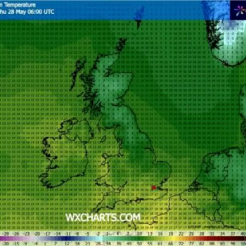
Maps from WXCHARTS show temperatures are set to drop, turning from blazing red to icy blue. After recent highs potentially reaching 33°C or even 34°C, large parts of the UK will tumble back to single-digit temperatures. According to the forecast, on Thursday, May 28, at 6am, Scotland could see lows of just 5°C.
The coldest reading is expected in Cairngorms National Park, though across Scotland as a whole, temperatures will sit between 5°C and 9°C. In England, the chilliest conditions will be felt across the North East, where the thermometer will hover between 8°C and 10°C.
Wales and Northern Ireland can both expect temperatures ranging from 12°C to 15°C, should the map prove accurate. The mildest conditions will be found along the south coast, with highs of around 16°C or 17°C, WXCharts adds.
Record-Breaking Heat Precedes the Drop
The dramatic shift follows a period of glorious sunshine across Britain, with yesterday marking the hottest May day ever recorded. Temperatures peaked at 34.8°C at Kew Gardens, surpassing the previous record by 2°C. Hannah Cloke, Regius Professor of Meteorology and Climate at the University of Reading, told BBC Radio 4's World At One programme that "this is what climate change feels like".
Met Office Forecast
The Met Office, in its own separate five-day forecast, states that much of the country will remain dry today, with the most intense heat concentrated towards the southwest. For later today, it adds: "Sunny spells for much of the UK, however cloudier in the northeast with bright spells developing here later. Dry for most, but a few showers possible across the south. Hot in the southwest, but feeling a little fresher elsewhere."
Regarding tonight, forecasters indicate there will be "scattered showers and thunderstorms possibly moving north across England and Wales overnight". Conditions will otherwise remain dry with clear intervals, though low cloud is expected to return across the northeast. Temperatures will drop notably compared to recent nights.
For Thursday, the forecast states: "Mostly dry with sunny spells, but also a few showers and thunderstorms possibly breaking out across England & Wales later in the day. Warmer again for many."
Looking ahead to Friday through Sunday: "Largely dry with sunny spells and very warm once again on Friday. A band of rain then gradually spreading eastwards over the weekend introducing some fresher and possibly showery conditions."
Full List of Coldest Counties, According to WXCharts
Scotland
Aberdeen City, Aberdeenshire, Angus, Argyll and Bute, Clackmannanshire, Dundee, East Dunbartonshire, East Renfrewshire, Falkirk, Fife, Glasgow, Highland, Inverclyde, Midlothian, Moray, Orkney, Perth and Kinross, Renfrewshire, Shetland Isles, Stirlingshire, West Dunbartonshire, West Lothian, Western Isles.
England
Cumbria, Durham, East Riding of Yorkshire, Lancashire, North Yorkshire, Northumberland, Tyne and Wear.