
Britain could be facing a major winter weather event later this month, as early forecast models indicate the potential for a significant snowstorm sweeping in from the continent.
The Forecast: A 600-Mile Snow Blanket
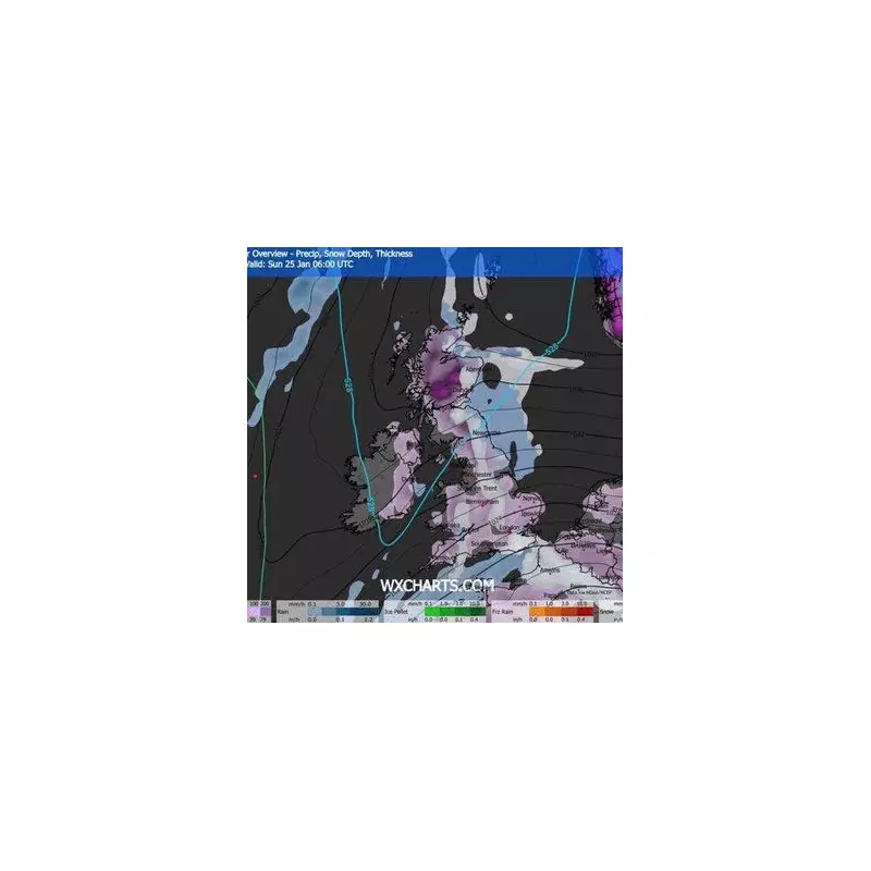
Advanced weather maps from GFS suggest a substantial weather front will move across the UK from the East on 23 January 2026. This system is projected to blanket the country with snow, with the settled cover stretching an impressive 600 miles from the south coast of England to the far north of Scotland.
The snowfall is expected to begin around midday on the 23rd and persist through 24 January, impacting Wales and Northern Ireland as well. While the direction of the storm evokes memories of the infamous Beast from the East in 2018, current data suggests accumulations will be less extreme.

Which Cities Are in the Firing Line?
Weather charts pinpoint twelve principal UK cities that are likely to see snow flurries from this event. The affected urban centres span the length of the nation.
- London
- Bristol
- Cardiff
- Birmingham
- Nottingham
- Norwich
- Manchester
- Newcastle
- Edinburgh
- Glasgow
- Dundee
- Aberdeen
The data indicates that Scotland could see the heaviest falls, with up to eight inches settling in some areas. Northern England may get around two inches, while other regions could see roughly one inch.
Long-Range Outlook and Official Forecasts
The BBC Weather's long-range forecast for the period 19th to 25th January offers a note of caution. It states the chance of meaningful, widespread snowfall is currently low, but admits some wintry showers are possible in northern regions, chiefly Scotland.
Looking further ahead to 26th January to 8th February, the BBC suggests the broader pattern is likely to remain mild and unsettled, driven by Atlantic systems. Any colder spells are expected to be short-lived, with significant wintry weather largely confined to Scotland's uplands.
However, forecasters acknowledge the inherent uncertainty of long-range predictions. They note there are tentative suggestions of high pressure building over Scandinavia, which, if it develops more strongly, could increase the chance of colder easterly flows. This is a scenario they advise keeping an eye on, even if it is not the most favoured outcome at present.
While the potential for a late-January UK snow forecast is capturing attention, residents are advised to monitor official updates from the Met Office as the predicted dates draw nearer for the most accurate and timely information.


