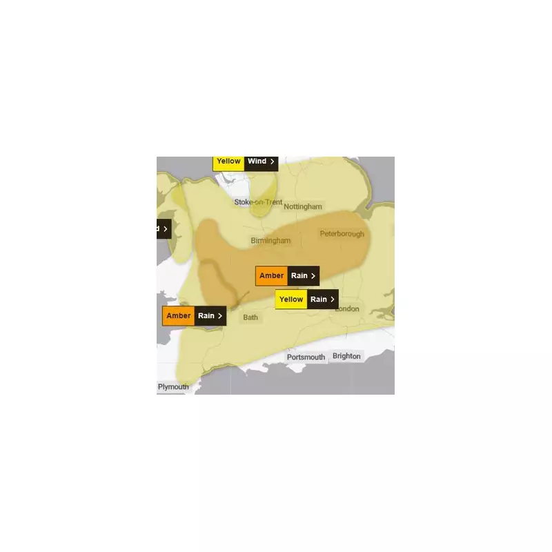
The Met Office has escalated its weather alert to a severe amber warning for rain, signalling a significant danger to life as Storm Claudia prepares to lash Birmingham and the wider West Midlands.
Immediate Impacts and Warning Details
The critical amber warning is scheduled to be active from noon until midnight on Friday, November 14. Forecasters predict that heavy and persistent rainfall associated with Storm Claudia will lead to widespread accumulations of 40-60 mm, with some localised areas potentially seeing up to 80 mm.
This intense downpour is expected to cause further deep and fast-flowing floodwater, creating life-threatening conditions. The Met Office has starkly outlined the severe risks residents should prepare for.

What to Expect from the Storm
The amber warning carries a grave message for the public. Key anticipated impacts include:
- Fast-flowing or deep floodwater likely, causing a genuine danger to life.
- Homes and businesses are likely to be flooded, with damage to buildings.
- Dangerous driving conditions and probable road closures due to spray and flooding.
- A high chance that some communities will be completely cut off by flooded roads.
- Likely delays and cancellations to train and bus services.
- Possible power cuts and loss of other essential services.
Weather Forecast and Outlook
The situation is set to deteriorate rapidly. While Thursday offers a drier and brighter day with temperatures up to 15°C, cloud will increase overnight with rain moving in. Friday will be widely wet with persistent, heavy rain and strong winds, making for a grim day with a maximum temperature of only 11°C.
The outlook for the weekend offers some respite, with conditions becoming more settled. Saturday may see a few light showers, but Sunday and Monday are expected to be drier, albeit colder, especially overnight.
Authorities are urging the public to avoid travelling through floodwater and to stay informed with the latest updates from the Met Office and local emergency services.