
The Met Office has escalated weather alerts across England, issuing yellow warnings for eight specific regions where residents are being strongly urged to prepare emergency kits and flood plans. This precautionary advice comes as forecasters predict further torrential downpours that could lead to significant flooding and widespread disruption.
Dual Yellow Warnings Issued for South West England
A yellow weather warning has been activated for Thursday, effective from midday through to midnight, covering extensive areas of South West England. A second, separate yellow warning will come into force from 9am on Friday, remaining active until 6am on Saturday, impacting overlapping regions. The Met Office has cautioned that these conditions "may lead to some flooding and disruption," prompting official guidance for resident preparedness.
Regions Under Immediate Alert
The following areas are under Thursday's weather warning:

- South West England
- Bournemouth Christchurch and Poole
- Cornwall
- Devon
- Dorset
- Plymouth
- Somerset
- Torbay
- Wiltshire
For Friday and Saturday, the warning specifically covers:
- South West England
- Cornwall
- Devon
- Plymouth
- Somerset
- Torbay
Aftermath of Storm Chandra Informs Current Warnings
These new alerts follow directly in the wake of Storm Chandra, which caused severe havoc across Devon and Cornwall earlier this week. The storm led to the closure of dozens of schools, businesses, and pubs, with emergency services forced to evacuate residents from flooded homes. In Devon alone, 47 schools remained closed on Tuesday, while major roads including sections of the A30 near Ottery St Mary and routes to Exeter Airport were rendered impassable.
Dorset Council has issued stark warnings to motorists, advising against driving through floodwater and emphasising the importance of heeding road closure signage. A council statement detailed: "Storm Chandra brought extremely heavy rain and rapid rises in river and groundwater levels alongside already waterlogged ground. In some places, river levels reached, or even passed, their highest ever recorded levels, causing water to spread over adjoining land and roads."
Resident Guidance for Flood Preparedness
Authorities are advising residents in the affected regions to take immediate proactive steps. Households are encouraged to assess whether their properties are vulnerable to flooding, develop a clear flood plan, and assemble an emergency kit containing essential supplies. This kit should include items such as torches, batteries, first aid supplies, important documents, and non-perishable food and water to sustain occupants for at least 72 hours if required.
Broader National Weather Forecast
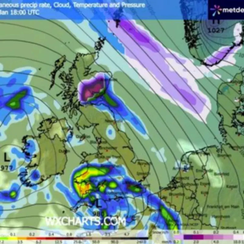
The Met Office's national outlook describes Thursday as a wet, breezy, and fairly cloudy day across the country, with rainfall and potential hill snow anticipated in northern regions. Looking ahead to Friday, conditions are predicted to be "rather cloudy and breezy with rain moving northwards, giving snow over some northern hills. Briefly brighter in the south, though heavier rain and especially brisk winds developing here."
The unsettled pattern is expected to persist through the weekend and into the start of next week. The forecast indicates "showers or longer spells of rain affecting most areas, coupled with brisk winds at times. Further snow on northern hills" from Saturday through Monday. Storm Chandra, the catalyst for the current situation, is the most recent storm to be formally designated by the western Europe storm naming group, a collaborative list shared between the UK, Ireland, and the Netherlands.


