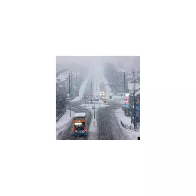
The Met Office has issued a specific weather alert, naming nine counties across England that are set to experience snowfall before the close of Monday. Forecasters have pinpointed the Pennines as a primary area where flurries are anticipated, as a new weather system moves in from the west.
Detailed Forecast and Affected Regions
According to the latest meteorological updates, the United Kingdom is expected to have a relatively calm start to Monday for many areas, with some patches of fog likely. However, conditions are predicted to change later in the day as a new frontal system approaches from the west. This system is forecast to bring rain into Northern Ireland and western parts of Britain initially.
Interaction of Weather Fronts
In an official press release, Met Office meteorologists explained that as this incoming front encounters the colder air being pushed from the east across the northern half of the UK, snow becomes possible on the leading edge over higher ground. This interaction is particularly expected in elevated areas such as the Pennines and the Scottish mountains.

The Pennines, often referred to as the "backbone of England," span several northern counties. The regions primarily covered include Northumberland, Cumbria, Durham, Yorkshire, Lancashire, Greater Manchester, Cheshire, Derbyshire, and Staffordshire. These are the nine counties highlighted by the Met Office for potential snowfall.
Historical Weather Patterns and Broader Implications
Ian Simpson, a forecaster from Netweather, provided additional context by comparing current conditions to late January 2014. He noted that the weather patterns are quite reminiscent of that period, which featured a pronounced Scandinavian blocking high. However, instead of resulting in cold easterlies, lows from the North Atlantic became stuck to the west and south-west of Britain, leading to a mild and very wet regime.
The winter quarter of 2013/14 was exceptionally wet for much of Britain and notably snow-free at low levels, although the Scottish Highlands experienced significant snowfall. If the current pattern persists through the remainder of January and into February, there is a growing risk of flooding, especially in the west and south of Britain, where particularly wet conditions are expected in the coming week.
Rainfall Predictions and Further Weather Systems
Some forecast model runs suggest that parts of south-west England could receive over 100mm of rain in the next ten days, highlighting the potential for severe weather beyond the immediate snow alert. The Met Office has also indicated that another deep area of low pressure could approach the south-west of the UK through Tuesday morning, although there is still some uncertainty at this range.
This potential system might bring another day of very wet and windy conditions to areas already affected by stormy weather throughout January. Alternative scenarios could see the low track further south, which would reduce the risk of impactful weather for the UK. Residents in the named counties are advised to stay updated with the latest forecasts and prepare for possible travel disruptions due to snow and adverse conditions.