
The Met Office has activated a yellow weather warning for rain across two specific areas of the West Midlands as Storm Chandra sweeps across the United Kingdom. This alert highlights significant concerns for residents in the identified counties, with forecasts predicting substantial rainfall and associated disruptions.
Targeted Warning for Herefordshire and Shropshire
Weather authorities have pinpointed Herefordshire and Shropshire as the primary locations within the West Midlands expected to experience the most severe impacts from Storm Chandra. The warning period extends from 1pm on Monday, January 26, 2026, through to 10am on Tuesday, January 27, 2026.
Meteorologists anticipate outbreaks of heavy rain that could lead to transport difficulties and localised flooding in these areas. The situation is exacerbated by already saturated ground from previous wet conditions, which may amplify flooding risks.

Detailed Forecast and Expected Impacts
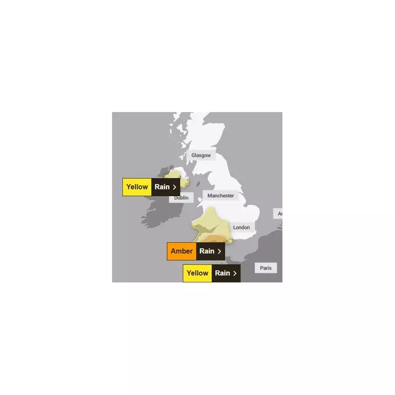
The Met Office has provided specific details about Storm Chandra's expected trajectory and effects. The weather system is bringing persistent rainfall across southern and southwestern England, as well as southern and mid Wales, beginning Monday afternoon and continuing through Tuesday morning before transitioning to heavy showers.
Rainfall accumulations are forecast to reach:
- 20-30 mm across widespread areas
- 50-80 mm on higher ground, particularly affecting Dartmoor, Exmoor and Bannau Brycheiniog (Brecon Beacons)
In addition to the heavy precipitation, strong southeasterly winds are expected to accompany the rainfall, potentially increasing the severity of weather conditions in affected regions.
Official Safety Advice from the Met Office
For residents living within the yellow warning zones, the Met Office has issued comprehensive guidance to help mitigate potential risks:
- Flood Preparedness: Assess whether your property might be vulnerable to flooding and consider developing both a flood plan and an emergency flood kit.
- Travel Planning: Check road conditions before driving and review bus and train timetables to minimise potential delays. Be prepared to alter travel arrangements if necessary.
- Power Outage Readiness: Prepare for possible power disruptions by gathering essential items including torches, batteries, and mobile phone power packs.
- Weather Monitoring: Stay informed about rapidly changing weather conditions by regularly checking local forecasts, as weather warnings can be updated frequently.
Broader Weather Patterns Across the Region
While the yellow warning specifically targets Herefordshire and Shropshire, other parts of the West Midlands are also expecting rainfall. Birmingham, though not currently under the formal warning, is forecast to experience rain throughout Monday and Tuesday.
The detailed Met Office forecast for the broader region indicates:
Today (Monday): Predominantly cloudy and chilly conditions with occasional bright intervals possible in eastern areas. Breezier conditions developing later with rain likely to arrive from the west by late afternoon. Maximum temperatures reaching 4°C.
Tonight: Strengthening winds as rain spreads eastward. Rainfall intensifying during early hours, potentially causing surface water issues and localised flooding. Wind speeds peaking just before dawn. Minimum temperatures dropping to 3°C.
Tomorrow (Tuesday): Rain moving northward but remaining heavy in northeastern areas into the afternoon. Clearer, brighter periods developing later in the day, though further showers expected in western regions. Maximum temperatures rising to 8°C.
Residents across the West Midlands are advised to remain vigilant and follow official guidance as Storm Chandra progresses through the region.


