
Met Office Issues Comprehensive Snow Warning for Saturday Across UK Regions
The Met Office has issued a significant weather warning, indicating that substantial snowfall is anticipated to impact various parts of the United Kingdom tomorrow, Saturday, January 24. Forecasters predict that towns and cities, especially those north of the border in Scotland, will face a renewed onslaught of wintry conditions driven by Atlantic weather systems.
Detailed Weather Outlook for the Weekend
According to the latest meteorological assessment, the initial conditions on Saturday will see rain and hill snow across the northeast gradually easing. However, elsewhere in the country, showers are expected to frequently merge into more prolonged periods of rainfall, particularly affecting the southwest regions. The forecast highlights that windy conditions will be widespread, with coastal gales posing additional hazards.
The outlook for the period from Sunday to Tuesday remains unsettled, with bands of rain forecast to move north and east across the nation. A gradual cooling trend is anticipated from the northeast, increasing the risk of snowfall, especially over northern hills, as the week progresses.

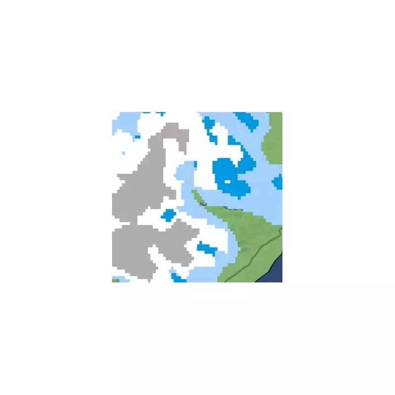
Specific Areas Identified for Snowfall
Maps generated for late Friday evening pinpoint several locations already experiencing snow, including Foyers, Dalwhinnie, Fort William, Grantown-on-Spey, and Kingussie, along with Glendoll Lodge. Additional patches of snow are observed above Wick and Ullapool, indicating the spread of wintry precipitation.
By Saturday, the snowfall is projected to persist over these affected areas but at a significantly heavier intensity. Forecasts indicate patches of white snow cover extending across northern and central Scotland, with the snow expected to intensify throughout the day, eventually reaching from the northern tip of Scotland down to Fort William.
Full List of Locations Under Snow Warning
The Met Office has named the following areas that are likely to face snow on Saturday:
- Dalwhinnie
- Fort William
- Loch Rannoch
- Pitagowan
- Pitlochry
- Glendoll Lodge
- Kingussie
- Foyers
- Loch Ossian
- Fort Augustus
- Fasnaloich
- Finnart
- Crieff
- Crianlarich
- Strathyre
- Grantown-on-Spey
- Aberlour
- Wick
Expert Commentary and Additional Warnings
Simon King, a meteorologist from BBC Weather, has corroborated the Met Office alerts, noting that weather warnings have been issued for wind and rain across parts of the UK. He explained that very wet conditions will continue to affect eastern Scotland, while Storm Ingrid, named by the Portuguese weather service, is expected to bring further rainfall to England and Wales.
King emphasised that strong winds will accompany the rain, particularly in south-west England where coastal gales are forecast. This combination of weather elements is likely to result in travel disruption due to potential flooding. Moreover, large waves combined with high tides may lead to coastal overtopping, creating additional hazards for residents and travellers in affected regions.
Residents in the listed areas are advised to stay updated with the latest forecasts and prepare for possible travel delays and hazardous conditions as the wintry weather unfolds.


