Birmingham City Council has approved plans for a 20-metre 5G mast on Walsall Road in Sutton Four Oaks, concluding that the benefits of improved digital connectivity outweigh the 'limited harm' and 'intrusion' concerns raised by residents and local councillors.
The mast, proposed by Jet Infrastructure Ltd, will be located on land opposite 101 Walsall Road, near several homes and The Crown pub. It is designed to provide the latest 4G and 5G technologies, with the council stating there is a 'specific requirement' for coverage at this location.
Local opposition and councillor concerns
The plans drew backlash from Sutton Town Council, which argued that 'locating a 20m high pole at such an exposed location would result in an adverse visual impact for neighbouring properties.' The town council suggested an alternative location should be found and said it would not support the proposal.

Other letters of objection raised fears that the mast could be an 'overbearing feature beside a public footpath.' Sutton Four Oaks councillor Raaj Shamji spoke about residents' concerns at a recent planning meeting, arguing the mast would appear 'visually dominant and out of keeping with the surrounding low-rise residential character.'
Councillor Martin Brooks, chair of the planning committee, acknowledged the difficulty of the decision at the meeting, saying: 'This is indeed a difficult one. It's difficult to argue that a 20m mast is not somewhat intrusive of people living very close by.' However, he compared the proposed mast to similar infrastructure, adding: 'It may not be perfect but I think the single 20m pole is a great advantage to what it could be. I understand residents' concerns but access to digital services is really important in terms of the future of the city.'
Committee divided but ultimately approves
Councillor Gareth Moore also noted the divisive nature of the proposal, stating: 'We need more 5G, we need to invest in technology. But I understand these masts are controversial in themselves.' He added that he was concerned about the grass verge at the site becoming 'cluttered' and 'unsightly.'
Councillor Manni Butt said: 'If we want to improve the digital infrastructure in our city, I think we should be supporting it.' The committee ultimately voted to allow the installation of the mast to go ahead.
Council report: benefits outweigh limited harm
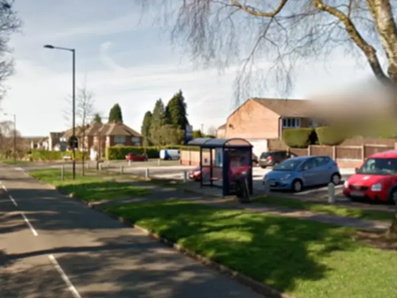
In a report, a council officer acknowledged that the proposal would be visible by pedestrians and motorists along Walsall Road, but noted that 'there are various street structures within the proximity of the site, including a bus shelter, signs, lamp posts and other telecoms equipment. As such, the proposed development would not appear as incongruous or as an isolated structure within this street scene.'
The report stated that the proposed infrastructure would be above the height of surrounding buildings and trees to provide 'clear sightlines and greater coverage,' accepting that 'screening can only be achieved to a certain degree.' It added: 'The site would be partially screened from the view by the row of existing highway trees, so the visual intrusion of the mast would be reduced.'
The council officer noted that national policies advise that 'significant weight' should be placed on the need to support economic growth and productivity. 'The need of such development (which includes social and economic benefits) should be weighed on balance, against any detrimental visual impact they may cause on Birmingham's environment,' the report said.
Mature trees lining the road, around 13 metres in height, were said to provide a 'substantial visual buffer' between the site and nearby homes. 'The distance separation, combined with the tree coverage, is considered sufficient. The proposal would not therefore harm the outlook from those properties or impact on residential amenity,' the report concluded.

Regarding site selection, the council officer said the applicant considered 40 alternative locations within the search area. 'Some of the locations were discounted due to those alternative locations being more prominent in terms of the proximity to the residential properties. Other alternative sites were discounted due to being close to more sensitive locations. Other sites were discounted due to the height of the trees that would impact on the coverage and not providing the level of coverage required.'
The application site was chosen as the 'least harmful option' in terms of its proximity to nearby homes. The council officer concluded that the proposal's benefits and the absence of a more suitable alternative site 'outweighs the limited harm.'