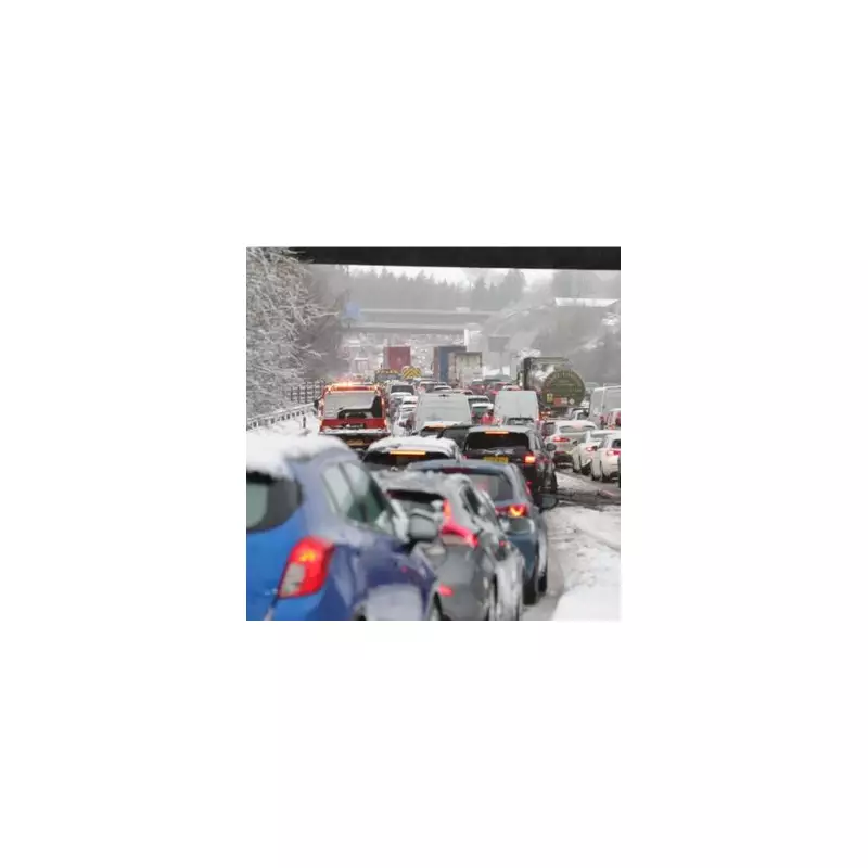
The Met Office has issued a long-range forecast indicating that the UK could experience one or more spells of snow in the days leading up to Christmas, alongside an increased risk of frost and fog.
From Autumn Chill to Winter Spells
A noticeable wintry chill has already settled across the United Kingdom in recent days, with temperatures dropping steadily as autumn progresses. Weather experts at the Met Office are now predicting that this trend will continue, with an increased risk of frost and fog developing before colder conditions become more established next month.
While periods of wind and rain are still possible, the forecast suggests they may be less frequent than usual at first. The dominant feature, however, is the expectation of colder spells moving in, bringing with them the potential for snowfall.

Detailed Met Office Forecast: Late November to Mid-December
In its specific outlook for the period from Wednesday, November 26, to Friday, December 5, the Met Office describes a changeable picture. After a settled start for much of England, conditions are expected to quickly turn unsettled across Scotland, Wales, and then the rest of England through Wednesday and Thursday.
Atlantic weather systems will bring cloud and rain, heralding a shift towards more changeable or even unsettled conditions. The forecast also notes there will be some short-lived settled periods, which could bring that increased risk of frost and fog for a day or two.
Towards the end of this period, there is an increasing chance of more settled spells returning, although the Met Office states that confidence is very low by this point. Temperatures are expected to start cold across England and Wales on Wednesday before rising as Atlantic systems arrive, likely remaining above average for much of this period.
Looking Further Ahead: Early to Mid-December
Looking further ahead from Saturday, December 6, to Saturday, December 20, the Met Office indicates an increased chance of settled spells at first. This would bring more dry weather, light winds, and a continued heightened risk of overnight fog and frosts.
This pattern is associated with more frequent periods of high pressure, which are expected to be located to the north or east of the UK. While spells of wind and rain remain possible, they may be less frequent than usual initially. However, a steady increase in unsettled weather across southern and western areas seems likely as this period progresses.
Overall, above-average temperatures are slightly more probable, but the Met Office cautions that colder spells could still occur, especially at first and in northern regions. Crucially, the forecast concludes that one or more spells of snow cannot be ruled out, particularly if weather systems arrive from the south and interact with colder air already in place over the UK.