
The Met Office has released detailed snow maps and charts forecasting a significant winter storm set to blanket numerous regions across the United Kingdom this weekend. According to the latest data available on the Met Office website, accumulations of snowfall are expected to make landfall around midnight on Sunday, February 15, with the event lasting approximately 12 hours.
Timeline of the Snow Event
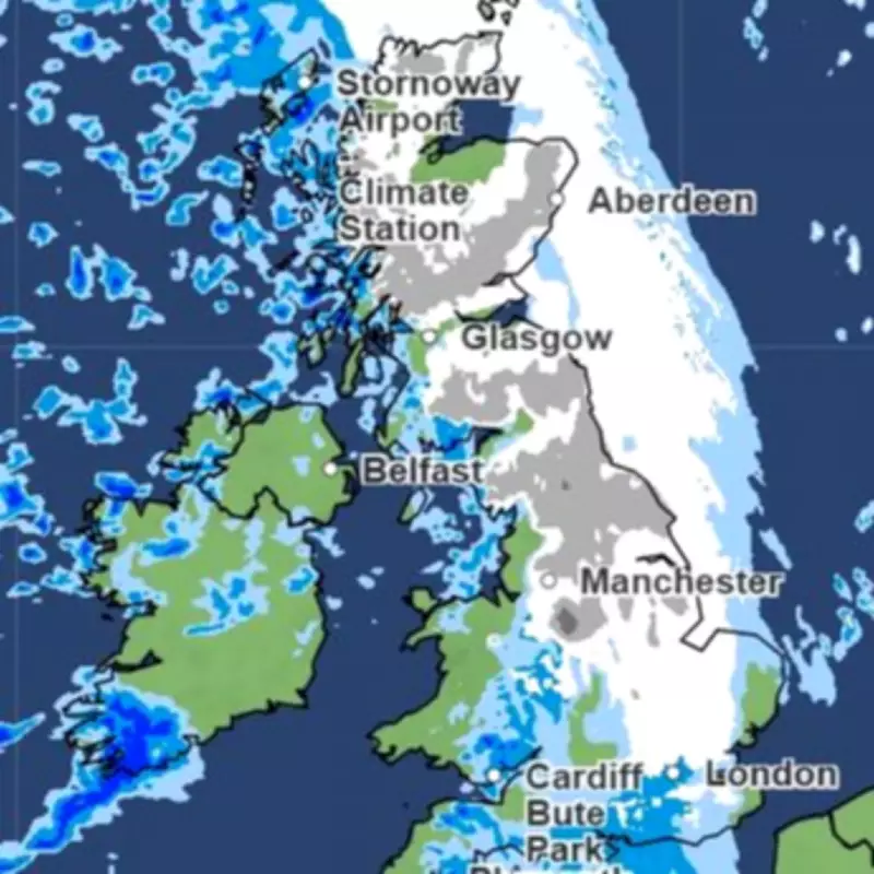
Initially, a massive band of flurries will sweep in from the Atlantic, hammering the west coast in the early hours from midnight. A strip of snow is projected to stretch from Swindon in Wiltshire all the way to the northern tip of Scotland, covering areas such as the Highlands, northern England, the East Midlands, and the West Midlands with Arctic showers.
Morning Progression
By 6 a.m., the snow will shift slightly eastward, sparing regions like Gloucestershire, Oxfordshire, and Warwickshire. However, Cambridgeshire and the East of England, including Norfolk and Suffolk, will be blanketed, while Wales becomes dry of flurries.

At 9 a.m., the flurries will disappear from the Midlands, but further accumulations are anticipated in East Anglia, Greater London, some Home Counties, and the North East. By noon, only the northernmost tip of East Anglia will see lingering snow, with the rest of England clearing up.
Forecast Details and Expert Insights
The Met Office forecast for the period from Friday, February 13 to Sunday, February 15 advises that rain will continue moving southwards, with Northern Ireland and Scotland experiencing some sunshine but snow showers around the coasts. The outlook for Saturday to Monday indicates bright skies with sunny spells on Saturday, feeling much colder, turning wetter on Sunday with widespread snow likely across the north, and remaining unsettled into next week.
James Madden from Exacta Weather provided additional insights, stating that wintry conditions and snow showers will form from later this evening, spreading southwards into parts of northern and north-east England, Northern Ireland, and potentially central England and Wales, continuing throughout Friday.
Affected Areas
Based on the Met Office snow map, the following regions are expected to face snow:
- Scotland
- North West England
- North East England
- West Midlands
- East Midlands
- Cotswolds
- Wales
- East of England
- South East England
- Greater London
This forecast highlights a significant weather event that could impact travel and daily activities across the UK, urging residents to stay informed and prepared for wintry conditions.


