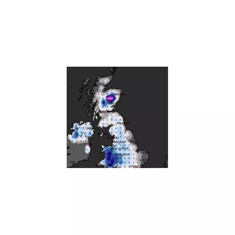
Fresh weather maps have charted the precise path of an incoming snow storm that is set to target Birmingham and the wider West Midlands region as part of a major Arctic blast. The latest meteorological projections indicate that wintry conditions will intensify significantly from Tuesday, January 27, with the potential for disruptive snowfall across much of the country.
Timeline of the Incoming Snowfall
The cold snap, driven by a surge of frigid Arctic air, is expected to cause temperatures to plummet into low single digits from the beginning of next week. Forecasts specifically highlight Tuesday as the likely commencement point for snowfall in Birmingham and surrounding areas of the West Midlands.
Peak Snowfall Expected Midweek
Meteorological models suggest that the most substantial accumulation could occur on Wednesday, January 28. Some parts of the region may experience up to seven inches of heavy snow, creating potentially hazardous travel conditions and significant disruptions.
The widespread nature of this weather event means much of the UK could be blanketed in snow on that day. Current projections indicate that blizzard-like conditions may persist through to Friday, January 30, extending the period of wintry weather across the Midlands and beyond.
Official Met Office Forecast Analysis
The Met Office's extended outlook for January 25 to February 3 provides crucial context for this developing situation. Their forecast states: "Weather systems moving in from the Atlantic will continue to attempt to push in from the west, but tending to stall in the vicinity of the UK as they encounter high pressure to the north and northeast."
The forecast continues: "As a result, further spells of rain or showers are likely at times. These may be heavy and persistent, especially in the south and west, with the best of any drier interludes in the far north and northeast."
Regarding temperature trends, the Met Office adds: "Whilst mild conditions are expected to encroach into the south and southwest at times, it is likely to turn somewhat colder through this period, bringing the risk of some snow showers, most likely across hills in Scotland and northern England."
Regional Impact Assessment
While the forecast mentions snow showers being most likely across northern hills initially, the developing weather patterns suggest the Arctic blast will extend its reach southward. Birmingham and the West Midlands appear particularly vulnerable to this southward push of cold air interacting with incoming moisture.
Residents across the region are advised to monitor weather updates closely and prepare for possible travel disruptions, school closures, and the need for additional winter precautions as this significant snow system approaches the UK.


