The UK heatwave, which has brought record-breaking warm and dry weather this summer, is set to continue into next week, with no substantial rain forecast for many parts of England.
Record-Breaking Heat Persists
Many may have hoped for some respite from the warm conditions that have dominated the summer, but latest forecasts show there is no end in sight. While there was a cooler feel at the start of this week, temperatures are set to climb again as the week progresses, with the mercury potentially reaching 33C in the south of England.
Any chance of substantial rain appears remote for now in most areas, with sunshine forecast heading into next week. It may leave some wondering when this record-breaking warm spell will come to an end.

Pressure on Water Supplies and Wildfire Risk
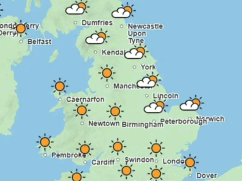
The continued dry weather will ramp up pressure on water supplies amid hosepipe bans and warnings over usage, and increase the prospect of further wildfires. Met Office weather maps heading into the start of next week show sunshine and clear skies for many parts of England.
Experts suggest longer spells of rain could finally arrive from the end of July following the long bone-dry period.
Met Office Forecast for July 18-27
The forecast for July 18-27 states: "High pressure is likely to remain close to the UK into this period, and likely centred to the west or northwest of the country. This means plenty more dry weather for most if not all parts, though with the source region of the air being the North Atlantic, somewhat cooler, or at least less hot, conditions are expected, compared to many recent days."
Towards the latter part of July, the influence of high pressure may wane somewhat, allowing a greater chance of rain, showers or thunderstorms compared to earlier in the month. Overall, temperatures are expected to remain above average during this period.