The first full working week of 2026 is set to begin with significant disruption as fresh snow and ice are forecast to hit the West Midlands. The Met Office has issued a new yellow weather warning covering large parts of the region.
Warning Details and Affected Areas
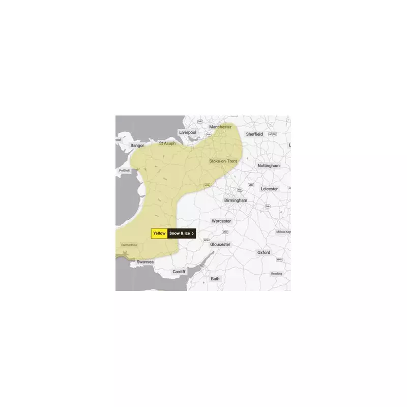
The yellow warning for snow and ice is active from 3pm on Sunday, 4th January, until noon on Monday, 5th January. It spans north and west Wales and extends into the West Midlands.
Areas specifically highlighted include Stoke-on-Trent, parts of Staffordshire and Shropshire. The warning zone comes within a few miles of Wolverhampton and other Black Country towns, raising the prospect of widespread impact.

Timing and Expected Accumulations
Flurries are predicted to start from around 4pm on Sunday, continuing overnight into Monday morning. While coastal areas may see rain and sleet, inland showers are expected to fall as snow.
The Met Office states that while not every location will be affected, many places could see 1-3cm of accumulation by Monday morning. There is potential for 5-8cm to build up in a few spots, particularly across inland and higher ground in Wales.
Icy patches are also expected to form widely, adding to the hazardous conditions.
Potential for Travel Chaos
This fresh bout of wintry weather follows snowfall in parts of the region on Friday. It now threatens to cause major travel problems at the start of the first normal week after the Christmas break.
The Met Office alert warns: "Snow and ice has the potential to cause disruption to travel in places from Sunday evening through to Monday morning." Residents are advised to check forecasts and travel information before setting out.
With the warning in place for nearly 24 hours, commuters on Monday morning should prepare for difficult journeys and allow extra time.