
UK Braces for 600-Mile Snow Wall as Arctic Freeze Follows New York Blizzard
The United Kingdom is on high alert as advanced weather models predict a massive 600-mile wall of snow, stretching from northern Scotland down to Plymouth. This relentless Arctic assault is expected to move across the country during the opening week of March, potentially bringing up to 2 feet of accumulation in some regions.
Icy Blue Maps Signal Imminent Freeze
Weather maps across Britain have turned a chilling "icy blue," signalling an imminent Arctic freeze capable of blanketing the nation in snow. Simultaneously, the US East Coast continues to grapple with the aftermath of one of the largest blizzards in a decade that recently paralyzed New York City.
According to WXCharts data, some areas could be buried under snowfall accumulations reaching 59 centimetres, which translates to approximately 23 inches or nearly 2 feet. Heavy snowfall is forecast to intensify significantly on March 6, with Perth and Kinross identified as among the hardest-hit locations.

Met Office Issues Warnings for Widespread Impact
The Met Office has already issued warnings for the end of February, noting that snow is highly likely across high ground in northern regions. Forecasters also anticipate strong winds and a persistent risk of gales as the cold air becomes firmly established across the British Isles.
Major urban centres including Birmingham, Manchester, and London are all in the firing line for wintry flurries according to the latest ECMWF models. During the peak of the storm, some areas could experience snowfall rates reaching four inches per hour, creating potentially hazardous travel conditions.
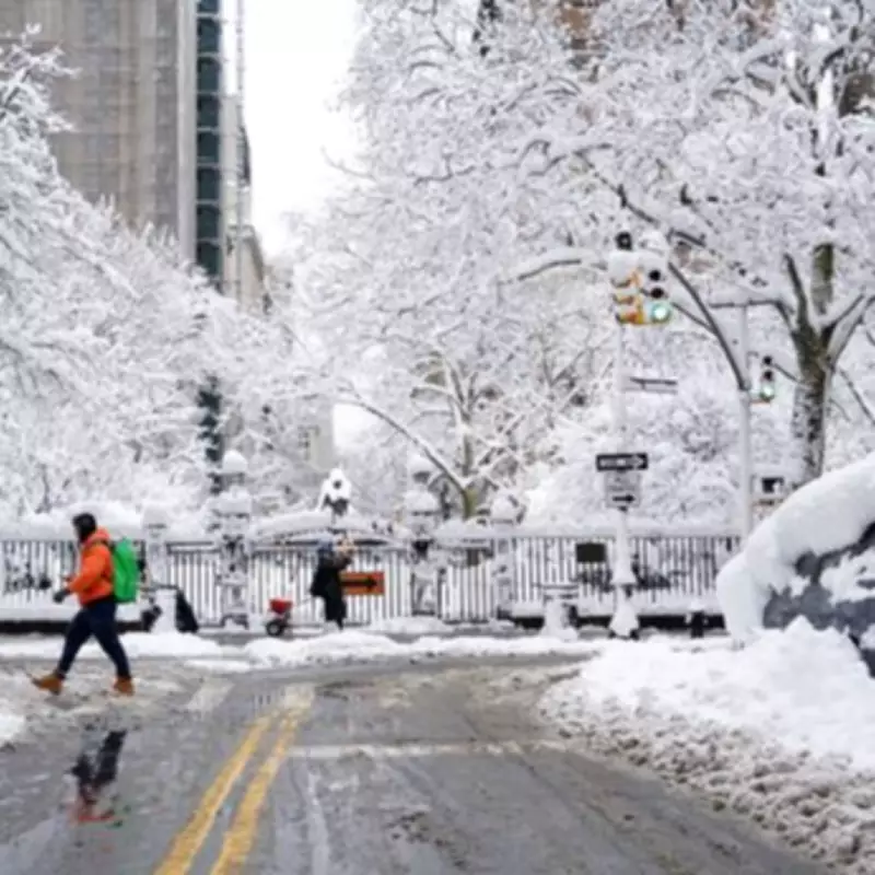
New York Digs Out from Historic Storm
While the UK prepares for its impending freeze, New York residents are currently digging out from a historic blizzard that dumped over 24 inches of snow across the five boroughs. This "ninth biggest storm in NYC history" brought the metropolis to a near standstill earlier this week.
New Yorkers faced sub-zero temperatures reaching -6°C during the storm, with "feels like" conditions plummeting as low as -13°C at the height of the blizzard. Authorities implemented massive power outages and comprehensive travel bans as the severe weather system moved through the North American northeast region.
Forecasting Challenges and Public Advice
Met Office experts emphasize that snow forecasting remains particularly tricky because tiny temperature shifts can determine whether precipitation falls as rain, sleet, or snow. They strongly recommend that the public check hourly updates frequently to stay informed about rapidly changing conditions throughout the impending weather event.
Despite the looming wintry hazards, there are early indications that high pressure may eventually bring quieter, more spring-like weather later in March. However, for the immediate future, much of the United Kingdom must prepare for sub-zero nights and treacherous icy patches on roads and pathways.
The combination of the New York blizzard and the approaching UK freeze highlights the significant weather patterns affecting both sides of the Atlantic as winter maintains its grip heading into early spring.


